You are here: Home > Network List > IU - Global Seismograph Network (GSN - IRIS/USGS) Stations List
> Station POHA Pohakuloa, Hawaii, USA > Earthquake Result Viewer
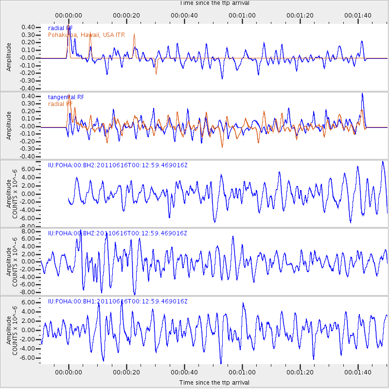
POHA Pohakuloa, Hawaii, USA - Earthquake Result Viewer
*The percent match for this event was below the threshold and hence no stack was calculated.
| Earthquake location: |
New Britain Region, P.N.G. |
| Earthquake latitude/longitude: |
-5.9/151.0 |
| Earthquake time(UTC): |
2011/06/16 (167) 00:03:35 GMT |
| Earthquake Depth: |
16 km |
| Earthquake Magnitude: |
6.1 MB, 6.5 MS, 6.3 MW, 6.2 MW |
| Earthquake Catalog/Contributor: |
WHDF/NEIC |
|
| Network: |
IU Global Seismograph Network (GSN - IRIS/USGS) |
| Station: |
POHA Pohakuloa, Hawaii, USA |
| Lat/Lon: |
19.76 N/155.53 W |
| Elevation: |
1990 m |
|
| Distance: |
58.4 deg |
| Az: |
62.615 deg |
| Baz: |
249.682 deg |
| Ray Param: |
$rayparam |
*The percent match for this event was below the threshold and hence was not used in the summary stack. |
|
| Radial Match: |
52.06367 % |
| Radial Bump: |
400 |
| Transverse Match: |
66.24852 % |
| Transverse Bump: |
400 |
| SOD ConfigId: |
558545 |
| Insert Time: |
2013-09-18 19:57:07.441 +0000 |
| GWidth: |
2.5 |
| Max Bumps: |
400 |
| Tol: |
0.001 |
|
Signal To Noise
| Channel | StoN | STA | LTA |
| IU:POHA:00:BHZ:20110616T00:12:59.469016Z | 2.2462108 | 3.6282272E-6 | 1.6152657E-6 |
| IU:POHA:00:BH1:20110616T00:12:59.469016Z | 0.56455827 | 1.1887472E-6 | 2.1056237E-6 |
| IU:POHA:00:BH2:20110616T00:12:59.469016Z | 0.7820815 | 1.4516091E-6 | 1.8560843E-6 |
| Arrivals |
| Ps | |
| PpPs | |
| PsPs/PpSs | |


