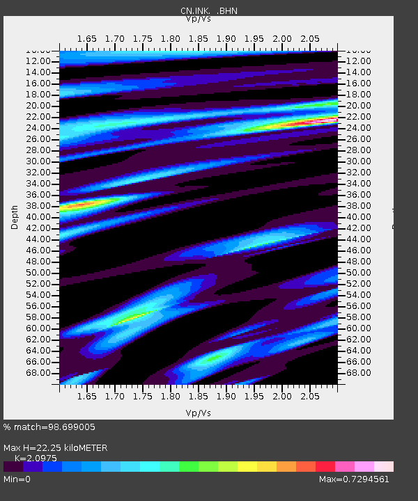
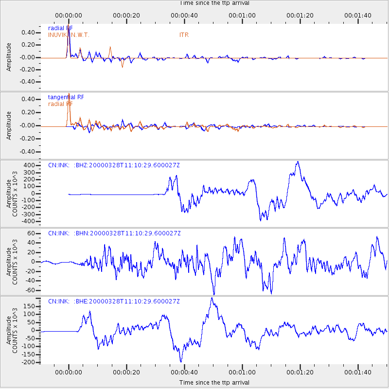
INK INUVIK, N.W.T. - Earthquake Result Viewer

Earthquake location: Volcano Islands, Japan Region
Earthquake latitude/longitude: 22.3/143.7
Earthquake time(UTC): 2000/03/28 (088) 11:00:22 GMT
Earthquake Depth: 126 km
Earthquake Magnitude: 6.8 MB, 7.6 MS, 7.6 MW, 7.6 MW
Earthquake Catalog/Contributor: WHDF/NEIC
Network: CN Canadian National Seismograph Network
Station: INK INUVIK, N.W.T.
Lat/Lon: 68.31 N/133.52 W
Elevation: 40 m
Distance: 66.8 deg
Az: 23.661 deg
Baz: 271.997 deg
Ray Param: 0.05704314
Estimated Moho Depth: 22.25 km
Estimated Crust Vp/Vs: 2.10
Assumed Crust Vp: 6.171 km/s
Estimated Crust Vs: 2.942 km/s
Estimated Crust Poisson's Ratio: 0.35
Radial Match: 98.699005 %
Radial Bump: 353
Transverse Match: 92.96492 %
Transverse Bump: 400
SOD ConfigId: 3744
Insert Time: 2010-02-27 06:04:56.551 +0000
GWidth: 2.5
Max Bumps: 400
Tol: 0.001

Signal To Noise

ChannelStoNSTALTA
CN:INK: :BHN:20000328T11:10:29.600027Z1.05378522235.82932121.7126
CN:INK: :BHE:20000328T11:10:29.600027Z12.1814218106.421486.3964
CN:INK: :BHZ:20000328T11:10:29.600027Z34.8970450567.0271449.0348
Arrivals
Ps4.1 SECOND
PpPs11 SECOND
PsPs/PpSs15 SECOND