You are here: Home > Network List > US - United States National Seismic Network Stations List
> Station EGMT Eagleton, Montana, USA > Earthquake Result Viewer
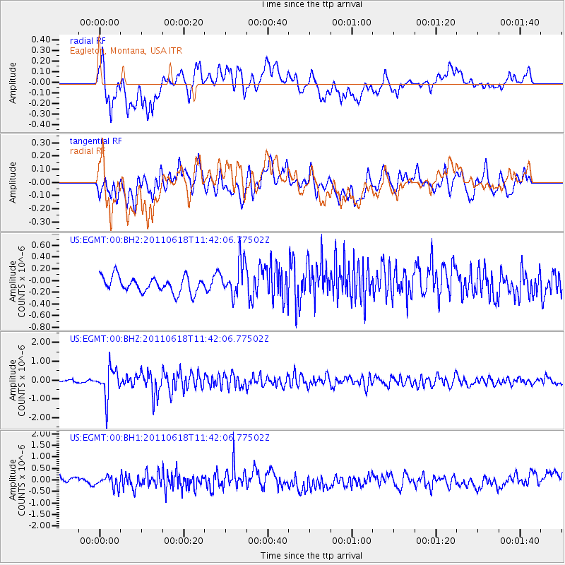
EGMT Eagleton, Montana, USA - Earthquake Result Viewer
*The percent match for this event was below the threshold and hence no stack was calculated.
| Earthquake location: |
Near East Coast Of Honshu, Japan |
| Earthquake latitude/longitude: |
37.7/141.7 |
| Earthquake time(UTC): |
2011/06/18 (169) 11:31:05 GMT |
| Earthquake Depth: |
20 km |
| Earthquake Magnitude: |
5.9 MB, 5.4 MS, 5.8 MW, 5.6 MW |
| Earthquake Catalog/Contributor: |
WHDF/NEIC |
|
| Network: |
US United States National Seismic Network |
| Station: |
EGMT Eagleton, Montana, USA |
| Lat/Lon: |
48.02 N/109.75 W |
| Elevation: |
1055 m |
|
| Distance: |
73.7 deg |
| Az: |
41.534 deg |
| Baz: |
308.385 deg |
| Ray Param: |
$rayparam |
*The percent match for this event was below the threshold and hence was not used in the summary stack. |
|
| Radial Match: |
54.939545 % |
| Radial Bump: |
400 |
| Transverse Match: |
60.552593 % |
| Transverse Bump: |
400 |
| SOD ConfigId: |
558545 |
| Insert Time: |
2013-09-18 20:01:00.713 +0000 |
| GWidth: |
2.5 |
| Max Bumps: |
400 |
| Tol: |
0.001 |
|
Signal To Noise
| Channel | StoN | STA | LTA |
| US:EGMT:00:BHZ:20110618T11:42:06.77502Z | 13.099469 | 8.159002E-7 | 6.228498E-8 |
| US:EGMT:00:BH1:20110618T11:42:06.77502Z | 2.223282 | 2.8968438E-7 | 1.3029582E-7 |
| US:EGMT:00:BH2:20110618T11:42:06.77502Z | 2.3247461 | 3.0999726E-7 | 1.3334672E-7 |
| Arrivals |
| Ps | |
| PpPs | |
| PsPs/PpSs | |


