You are here: Home > Network List > IU - Global Seismograph Network (GSN - IRIS/USGS) Stations List
> Station HNR Honiara, Solomon Islands > Earthquake Result Viewer
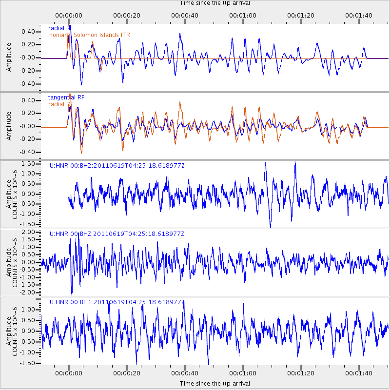
HNR Honiara, Solomon Islands - Earthquake Result Viewer
*The percent match for this event was below the threshold and hence no stack was calculated.
| Earthquake location: |
Southern Sumatra, Indonesia |
| Earthquake latitude/longitude: |
-3.2/101.4 |
| Earthquake time(UTC): |
2011/06/19 (170) 04:15:58 GMT |
| Earthquake Depth: |
57 km |
| Earthquake Magnitude: |
5.6 MB |
| Earthquake Catalog/Contributor: |
NEIC PDE/NEIC PDE-M |
|
| Network: |
IU Global Seismograph Network (GSN - IRIS/USGS) |
| Station: |
HNR Honiara, Solomon Islands |
| Lat/Lon: |
9.44 S/159.95 E |
| Elevation: |
100 m |
|
| Distance: |
58.5 deg |
| Az: |
99.025 deg |
| Baz: |
271.968 deg |
| Ray Param: |
$rayparam |
*The percent match for this event was below the threshold and hence was not used in the summary stack. |
|
| Radial Match: |
53.18616 % |
| Radial Bump: |
400 |
| Transverse Match: |
48.907322 % |
| Transverse Bump: |
400 |
| SOD ConfigId: |
558545 |
| Insert Time: |
2013-09-18 20:07:13.629 +0000 |
| GWidth: |
2.5 |
| Max Bumps: |
400 |
| Tol: |
0.001 |
|
Signal To Noise
| Channel | StoN | STA | LTA |
| IU:HNR:00:BHZ:20110619T04:25:18.618977Z | 3.571049 | 9.854987E-7 | 2.7596894E-7 |
| IU:HNR:00:BH1:20110619T04:25:18.618977Z | 0.81377685 | 4.5109982E-7 | 5.543286E-7 |
| IU:HNR:00:BH2:20110619T04:25:18.618977Z | 1.2250309 | 4.4016355E-7 | 3.593081E-7 |
| Arrivals |
| Ps | |
| PpPs | |
| PsPs/PpSs | |


