You are here: Home > Network List > US - United States National Seismic Network Stations List
> Station DGMT Dagmar, Montana, USA > Earthquake Result Viewer
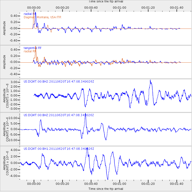
DGMT Dagmar, Montana, USA - Earthquake Result Viewer
*The percent match for this event was below the threshold and hence no stack was calculated.
| Earthquake location: |
Chile-Bolivia Border Region |
| Earthquake latitude/longitude: |
-21.7/-68.2 |
| Earthquake time(UTC): |
2011/06/20 (171) 16:36:01 GMT |
| Earthquake Depth: |
128 km |
| Earthquake Magnitude: |
6.0 MB, 6.5 MW, 6.5 MW |
| Earthquake Catalog/Contributor: |
WHDF/NEIC |
|
| Network: |
US United States National Seismic Network |
| Station: |
DGMT Dagmar, Montana, USA |
| Lat/Lon: |
48.47 N/104.20 W |
| Elevation: |
0.0 m |
|
| Distance: |
76.9 deg |
| Az: |
336.341 deg |
| Baz: |
145.891 deg |
| Ray Param: |
$rayparam |
*The percent match for this event was below the threshold and hence was not used in the summary stack. |
|
| Radial Match: |
96.502785 % |
| Radial Bump: |
267 |
| Transverse Match: |
75.98067 % |
| Transverse Bump: |
400 |
| SOD ConfigId: |
558545 |
| Insert Time: |
2013-09-18 20:13:08.768 +0000 |
| GWidth: |
2.5 |
| Max Bumps: |
400 |
| Tol: |
0.001 |
|
Signal To Noise
| Channel | StoN | STA | LTA |
| US:DGMT:00:BHZ:20110620T16:47:08.349026Z | 24.109436 | 3.7573789E-6 | 1.5584682E-7 |
| US:DGMT:00:BH1:20110620T16:47:08.349026Z | 2.8146625 | 8.125048E-7 | 2.8866864E-7 |
| US:DGMT:00:BH2:20110620T16:47:08.349026Z | 3.0659754 | 8.734684E-7 | 2.848909E-7 |
| Arrivals |
| Ps | |
| PpPs | |
| PsPs/PpSs | |


