You are here: Home > Network List > US - United States National Seismic Network Stations List
> Station WMOK Wichita Mountains, Oklahoma, USA > Earthquake Result Viewer
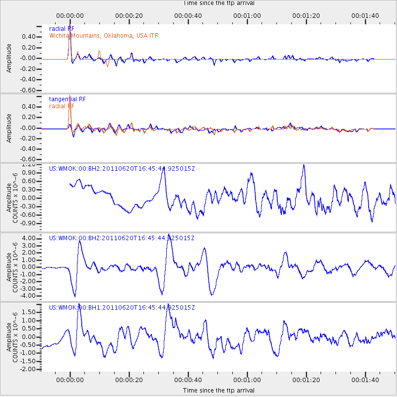
WMOK Wichita Mountains, Oklahoma, USA - Earthquake Result Viewer
*The percent match for this event was below the threshold and hence no stack was calculated.
| Earthquake location: |
Chile-Bolivia Border Region |
| Earthquake latitude/longitude: |
-21.7/-68.2 |
| Earthquake time(UTC): |
2011/06/20 (171) 16:36:01 GMT |
| Earthquake Depth: |
128 km |
| Earthquake Magnitude: |
6.0 MB, 6.5 MW, 6.5 MW |
| Earthquake Catalog/Contributor: |
WHDF/NEIC |
|
| Network: |
US United States National Seismic Network |
| Station: |
WMOK Wichita Mountains, Oklahoma, USA |
| Lat/Lon: |
34.74 N/98.78 W |
| Elevation: |
486 m |
|
| Distance: |
63.2 deg |
| Az: |
332.027 deg |
| Baz: |
148.017 deg |
| Ray Param: |
$rayparam |
*The percent match for this event was below the threshold and hence was not used in the summary stack. |
|
| Radial Match: |
74.0158 % |
| Radial Bump: |
321 |
| Transverse Match: |
27.072233 % |
| Transverse Bump: |
400 |
| SOD ConfigId: |
558545 |
| Insert Time: |
2013-09-18 20:14:36.099 +0000 |
| GWidth: |
2.5 |
| Max Bumps: |
400 |
| Tol: |
0.001 |
|
Signal To Noise
| Channel | StoN | STA | LTA |
| US:WMOK:00:BHZ:20110620T16:45:44.925015Z | 32.618347 | 2.4782205E-6 | 7.5976274E-8 |
| US:WMOK:00:BH1:20110620T16:45:44.925015Z | 1.3966258 | 9.4459097E-7 | 6.7633795E-7 |
| US:WMOK:00:BH2:20110620T16:45:44.925015Z | 1.4444067 | 5.182726E-7 | 3.5881348E-7 |
| Arrivals |
| Ps | |
| PpPs | |
| PsPs/PpSs | |


