You are here: Home > Network List > US - United States National Seismic Network Stations List
> Station NEW Newport, Washington, USA > Earthquake Result Viewer
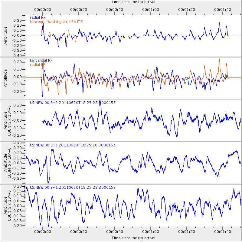
NEW Newport, Washington, USA - Earthquake Result Viewer
*The percent match for this event was below the threshold and hence no stack was calculated.
| Earthquake location: |
Vanuatu Islands |
| Earthquake latitude/longitude: |
-13.3/167.2 |
| Earthquake time(UTC): |
2011/06/20 (171) 18:13:21 GMT |
| Earthquake Depth: |
207 km |
| Earthquake Magnitude: |
5.7 MW |
| Earthquake Catalog/Contributor: |
NEIC PDE/NEIC PDE-M |
|
| Network: |
US United States National Seismic Network |
| Station: |
NEW Newport, Washington, USA |
| Lat/Lon: |
48.26 N/117.12 W |
| Elevation: |
760 m |
|
| Distance: |
90.5 deg |
| Az: |
40.347 deg |
| Baz: |
250.614 deg |
| Ray Param: |
$rayparam |
*The percent match for this event was below the threshold and hence was not used in the summary stack. |
|
| Radial Match: |
54.270237 % |
| Radial Bump: |
318 |
| Transverse Match: |
52.52219 % |
| Transverse Bump: |
400 |
| SOD ConfigId: |
558545 |
| Insert Time: |
2013-09-18 20:16:14.026 +0000 |
| GWidth: |
2.5 |
| Max Bumps: |
400 |
| Tol: |
0.001 |
|
Signal To Noise
| Channel | StoN | STA | LTA |
| US:NEW:00:BHZ:20110620T18:25:28.300015Z | 2.5587406 | 2.0252439E-7 | 7.915003E-8 |
| US:NEW:00:BH1:20110620T18:25:28.300015Z | 0.98708504 | 9.000142E-8 | 9.1179E-8 |
| US:NEW:00:BH2:20110620T18:25:28.300015Z | 2.093595 | 1.2498705E-7 | 5.969973E-8 |
| Arrivals |
| Ps | |
| PpPs | |
| PsPs/PpSs | |


