You are here: Home > Network List > US - United States National Seismic Network Stations List
> Station EGMT Eagleton, Montana, USA > Earthquake Result Viewer
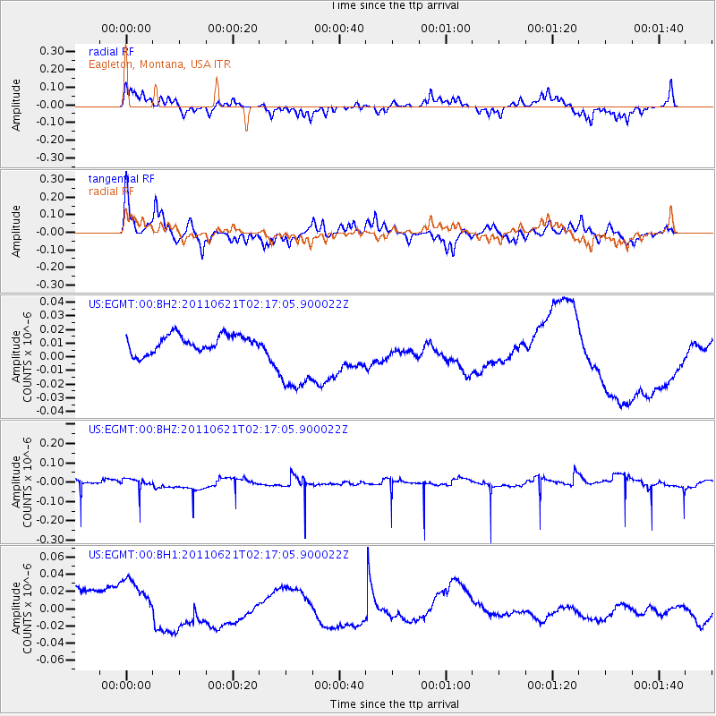
EGMT Eagleton, Montana, USA - Earthquake Result Viewer
*The percent match for this event was below the threshold and hence no stack was calculated.
| Earthquake location: |
Santa Cruz Islands |
| Earthquake latitude/longitude: |
-11.5/165.6 |
| Earthquake time(UTC): |
2011/06/21 (172) 02:04:15 GMT |
| Earthquake Depth: |
14 km |
| Earthquake Magnitude: |
5.8 MB, 5.8 MS, 6.0 MW, 6.0 MW |
| Earthquake Catalog/Contributor: |
WHDF/NEIC |
|
| Network: |
US United States National Seismic Network |
| Station: |
EGMT Eagleton, Montana, USA |
| Lat/Lon: |
48.02 N/109.75 W |
| Elevation: |
1055 m |
|
| Distance: |
94.9 deg |
| Az: |
42.136 deg |
| Baz: |
258.425 deg |
| Ray Param: |
$rayparam |
*The percent match for this event was below the threshold and hence was not used in the summary stack. |
|
| Radial Match: |
48.759876 % |
| Radial Bump: |
307 |
| Transverse Match: |
34.670994 % |
| Transverse Bump: |
304 |
| SOD ConfigId: |
558545 |
| Insert Time: |
2013-09-18 20:17:53.193 +0000 |
| GWidth: |
2.5 |
| Max Bumps: |
400 |
| Tol: |
0.001 |
|
Signal To Noise
| Channel | StoN | STA | LTA |
| US:EGMT:00:BHZ:20110621T02:17:05.900022Z | 0.8286196 | 3.2396013E-8 | 3.9096363E-8 |
| US:EGMT:00:BH1:20110621T02:17:05.900022Z | 1.1635764 | 4.7407926E-8 | 4.0743288E-8 |
| US:EGMT:00:BH2:20110621T02:17:05.900022Z | 4.69135 | 2.985648E-8 | 6.364155E-9 |
| Arrivals |
| Ps | |
| PpPs | |
| PsPs/PpSs | |


