You are here: Home > Network List > US - United States National Seismic Network Stations List
> Station HAWA Hanford, Washington, USA > Earthquake Result Viewer
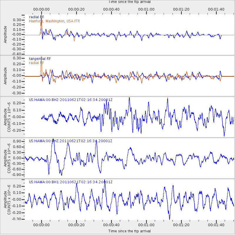
HAWA Hanford, Washington, USA - Earthquake Result Viewer
*The percent match for this event was below the threshold and hence no stack was calculated.
| Earthquake location: |
Santa Cruz Islands |
| Earthquake latitude/longitude: |
-11.5/165.6 |
| Earthquake time(UTC): |
2011/06/21 (172) 02:04:15 GMT |
| Earthquake Depth: |
14 km |
| Earthquake Magnitude: |
5.8 MB, 5.8 MS, 6.0 MW, 6.0 MW |
| Earthquake Catalog/Contributor: |
WHDF/NEIC |
|
| Network: |
US United States National Seismic Network |
| Station: |
HAWA Hanford, Washington, USA |
| Lat/Lon: |
46.39 N/119.53 W |
| Elevation: |
364 m |
|
| Distance: |
88.1 deg |
| Az: |
41.965 deg |
| Baz: |
251.267 deg |
| Ray Param: |
$rayparam |
*The percent match for this event was below the threshold and hence was not used in the summary stack. |
|
| Radial Match: |
78.668495 % |
| Radial Bump: |
400 |
| Transverse Match: |
75.33637 % |
| Transverse Bump: |
400 |
| SOD ConfigId: |
558545 |
| Insert Time: |
2013-09-18 20:17:54.157 +0000 |
| GWidth: |
2.5 |
| Max Bumps: |
400 |
| Tol: |
0.001 |
|
Signal To Noise
| Channel | StoN | STA | LTA |
| US:HAWA:00:BHZ:20110621T02:16:34.20001Z | 3.0055478 | 2.6510733E-7 | 8.8205994E-8 |
| US:HAWA:00:BH1:20110621T02:16:34.20001Z | 0.9654361 | 5.9000303E-8 | 6.1112594E-8 |
| US:HAWA:00:BH2:20110621T02:16:34.20001Z | 1.3055493 | 6.377596E-8 | 4.8849902E-8 |
| Arrivals |
| Ps | |
| PpPs | |
| PsPs/PpSs | |


