You are here: Home > Network List > CN - Canadian National Seismograph Network Stations List
> Station INK INUVIK, N.W.T. > Earthquake Result Viewer
INK INUVIK, N.W.T. - Earthquake Result Viewer

| Earthquake location: |
El Salvador |
| Earthquake latitude/longitude: |
13.0/-88.7 |
| Earthquake time(UTC): |
2001/01/13 (013) 17:33:32 GMT |
| Earthquake Depth: |
60 km |
| Earthquake Magnitude: |
6.4 MB, 7.8 MS, 7.7 MW, 7.5 ME |
| Earthquake Catalog/Contributor: |
WHDF/NEIC |
|
| Network: |
CN Canadian National Seismograph Network |
| Station: |
INK INUVIK, N.W.T. |
| Lat/Lon: |
68.31 N/133.52 W |
| Elevation: |
40 m |
|
| Distance: |
62.3 deg |
| Az: |
342.768 deg |
| Baz: |
129.06 deg |
| Ray Param: |
0.06018351 |
| Estimated Moho Depth: |
41.5 km |
| Estimated Crust Vp/Vs: |
1.61 |
| Assumed Crust Vp: |
6.171 km/s |
| Estimated Crust Vs: |
3.839 km/s |
| Estimated Crust Poisson's Ratio: |
0.18 |
|
| Radial Match: |
98.657486 % |
| Radial Bump: |
339 |
| Transverse Match: |
91.25292 % |
| Transverse Bump: |
400 |
| SOD ConfigId: |
3744 |
| Insert Time: |
2010-02-27 06:05:49.423 +0000 |
| GWidth: |
2.5 |
| Max Bumps: |
400 |
| Tol: |
0.001 |
|
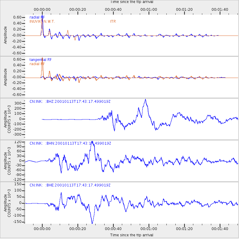
Signal To Noise
| Channel | StoN | STA | LTA |
| CN:INK: :BHN:20010113T17:43:17.499019Z | 2.7999444 | 6402.953 | 2286.8145 |
| CN:INK: :BHE:20010113T17:43:17.499019Z | 5.430639 | 8291.759 | 1526.8478 |
| CN:INK: :BHZ:20010113T17:43:17.499019Z | 11.962192 | 23203.68 | 1939.7515 |
| Arrivals |
| Ps | 4.3 SECOND |
| PpPs | 17 SECOND |
| PsPs/PpSs | 21 SECOND |


