AAK Ala Archa, Kyrgyzstan - Earthquake Result Viewer
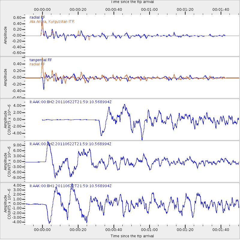
Earthquake location: Near East Coast Of Honshu, Japan
Earthquake latitude/longitude: 40.0/142.2
Earthquake time(UTC): 2011/06/22 (173) 21:50:52 GMT
Earthquake Depth: 33 km
Earthquake Magnitude: 6.7 MW, 6.1 MB, 6.7 MW, 6.7 MS
Earthquake Catalog/Contributor: NEIC PDE/NEIC PDE-M
Network: II Global Seismograph Network (GSN - IRIS/IDA)
Station: AAK Ala Archa, Kyrgyzstan
Lat/Lon: 42.64 N/74.49 E
Elevation: 1645 m
Distance: 49.7 deg
Az: 296.456 deg
Baz: 68.845 deg
Ray Param: 0.06847373
Estimated Moho Depth: 49.75 km
Estimated Crust Vp/Vs: 1.92
Assumed Crust Vp: 6.306 km/s
Estimated Crust Vs: 3.289 km/s
Estimated Crust Poisson's Ratio: 0.31
Radial Match: 95.23656 %
Radial Bump: 400
Transverse Match: 93.97505 %
Transverse Bump: 400
SOD ConfigId: 558545
Insert Time: 2013-09-18 20:24:08.003 +0000
GWidth: 2.5
Max Bumps: 400
Tol: 0.001

Signal To Noise

ChannelStoNSTALTA
II:AAK:00:BHZ:20110622T21:59:10.568994Z132.007145.9147765E-64.480649E-8
II:AAK:00:BH1:20110622T21:59:10.568994Z61.4248282.1121446E-63.4385845E-8
II:AAK:00:BH2:20110622T21:59:10.568994Z53.7446822.418297E-64.4996025E-8
Arrivals
Ps7.6 SECOND
PpPs22 SECOND
PsPs/PpSs29 SECOND