KAPI Kappang, Sulawesi, Indonesia - Earthquake Result Viewer
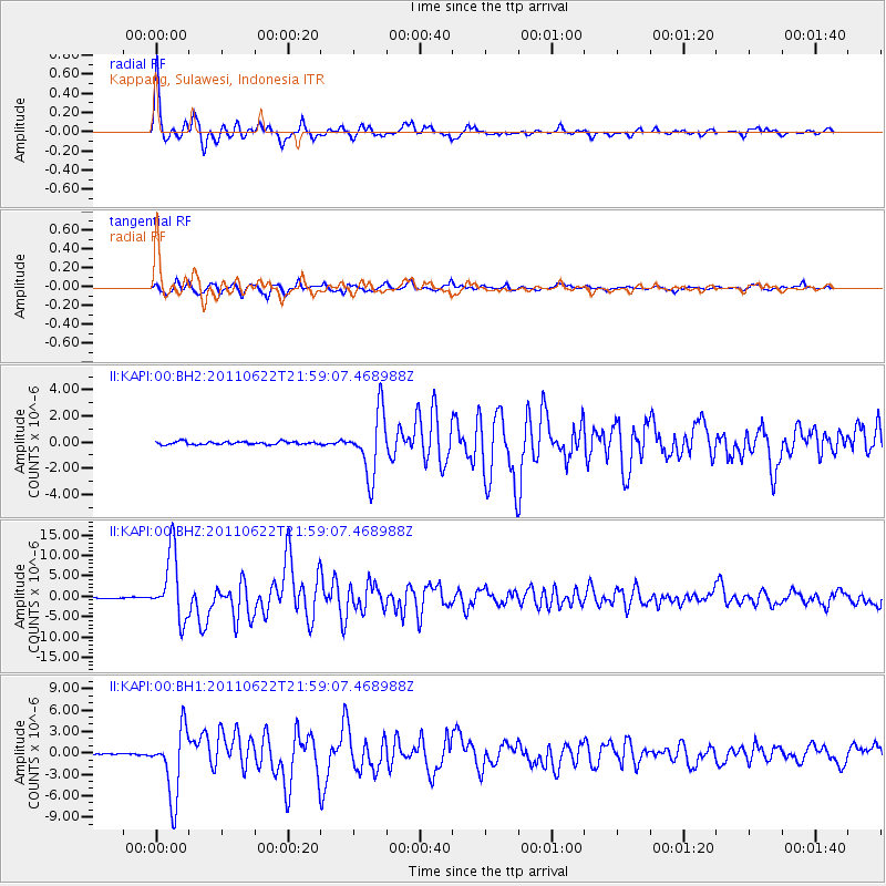
Earthquake location: Near East Coast Of Honshu, Japan
Earthquake latitude/longitude: 40.0/142.2
Earthquake time(UTC): 2011/06/22 (173) 21:50:52 GMT
Earthquake Depth: 33 km
Earthquake Magnitude: 6.7 MW, 6.1 MB, 6.7 MW, 6.7 MS
Earthquake Catalog/Contributor: NEIC PDE/NEIC PDE-M
Network: II Global Seismograph Network (GSN - IRIS/IDA)
Station: KAPI Kappang, Sulawesi, Indonesia
Lat/Lon: 5.01 S/119.75 E
Elevation: 300 m
Distance: 49.3 deg
Az: 210.127 deg
Baz: 22.785 deg
Ray Param: 0.068729445
Estimated Moho Depth: 35.25 km
Estimated Crust Vp/Vs: 1.78
Assumed Crust Vp: 6.343 km/s
Estimated Crust Vs: 3.569 km/s
Estimated Crust Poisson's Ratio: 0.27
Radial Match: 95.894966 %
Radial Bump: 400
Transverse Match: 90.45486 %
Transverse Bump: 400
SOD ConfigId: 558545
Insert Time: 2013-09-18 20:24:12.605 +0000
GWidth: 2.5
Max Bumps: 400
Tol: 0.001

Signal To Noise

ChannelStoNSTALTA
II:KAPI:00:BHZ:20110622T21:59:07.468988Z50.4289978.0740165E-61.6010664E-7
II:KAPI:00:BH1:20110622T21:59:07.468988Z53.3595854.7940057E-68.984338E-8
II:KAPI:00:BH2:20110622T21:59:07.468988Z21.1572022.3803777E-61.125091E-7
Arrivals
Ps4.6 SECOND
PpPs15 SECOND
PsPs/PpSs19 SECOND