PFO Pinon Flat, California, USA - Earthquake Result Viewer
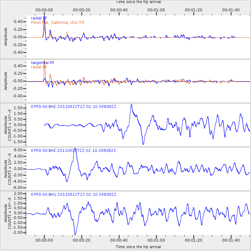
Earthquake location: Near East Coast Of Honshu, Japan
Earthquake latitude/longitude: 40.0/142.2
Earthquake time(UTC): 2011/06/22 (173) 21:50:52 GMT
Earthquake Depth: 33 km
Earthquake Magnitude: 6.7 MW, 6.1 MB, 6.7 MW, 6.7 MS
Earthquake Catalog/Contributor: NEIC PDE/NEIC PDE-M
Network: II Global Seismograph Network (GSN - IRIS/IDA)
Station: PFO Pinon Flat, California, USA
Lat/Lon: 33.61 N/116.46 W
Elevation: 1280 m
Distance: 76.9 deg
Az: 57.143 deg
Baz: 309.31 deg
Ray Param: 0.050623808
Estimated Moho Depth: 30.5 km
Estimated Crust Vp/Vs: 1.63
Assumed Crust Vp: 6.264 km/s
Estimated Crust Vs: 3.849 km/s
Estimated Crust Poisson's Ratio: 0.20
Radial Match: 95.75333 %
Radial Bump: 343
Transverse Match: 89.32461 %
Transverse Bump: 400
SOD ConfigId: 558545
Insert Time: 2013-09-18 20:24:18.565 +0000
GWidth: 2.5
Max Bumps: 400
Tol: 0.001

Signal To Noise

ChannelStoNSTALTA
II:PFO:00:BHZ:20110622T22:02:10.368982Z5.6407327.64963E-71.3561413E-7
II:PFO:00:BH1:20110622T22:02:10.368982Z2.07590752.6902083E-71.2959192E-7
II:PFO:00:BH2:20110622T22:02:10.368982Z2.4101412.2118309E-79.177184E-8
Arrivals
Ps3.2 SECOND
PpPs12 SECOND
PsPs/PpSs16 SECOND