You are here: Home > Network List > IU - Global Seismograph Network (GSN - IRIS/USGS) Stations List
> Station POHA Pohakuloa, Hawaii, USA > Earthquake Result Viewer
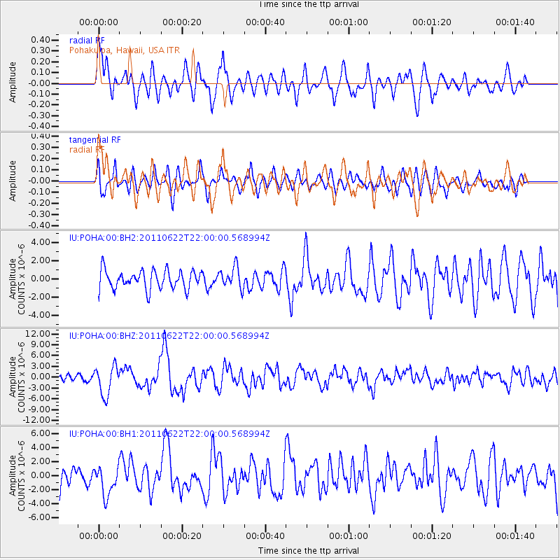
POHA Pohakuloa, Hawaii, USA - Earthquake Result Viewer
*The percent match for this event was below the threshold and hence no stack was calculated.
| Earthquake location: |
Near East Coast Of Honshu, Japan |
| Earthquake latitude/longitude: |
40.0/142.2 |
| Earthquake time(UTC): |
2011/06/22 (173) 21:50:52 GMT |
| Earthquake Depth: |
33 km |
| Earthquake Magnitude: |
6.7 MW, 6.1 MB, 6.7 MW, 6.7 MS |
| Earthquake Catalog/Contributor: |
NEIC PDE/NEIC PDE-M |
|
| Network: |
IU Global Seismograph Network (GSN - IRIS/USGS) |
| Station: |
POHA Pohakuloa, Hawaii, USA |
| Lat/Lon: |
19.76 N/155.53 W |
| Elevation: |
1990 m |
|
| Distance: |
56.5 deg |
| Az: |
91.519 deg |
| Baz: |
305.33 deg |
| Ray Param: |
$rayparam |
*The percent match for this event was below the threshold and hence was not used in the summary stack. |
|
| Radial Match: |
75.810425 % |
| Radial Bump: |
400 |
| Transverse Match: |
69.56386 % |
| Transverse Bump: |
400 |
| SOD ConfigId: |
558545 |
| Insert Time: |
2013-09-18 20:25:09.646 +0000 |
| GWidth: |
2.5 |
| Max Bumps: |
400 |
| Tol: |
0.001 |
|
Signal To Noise
| Channel | StoN | STA | LTA |
| IU:POHA:00:BHZ:20110622T22:00:00.568994Z | 5.447751 | 4.1892818E-6 | 7.689929E-7 |
| IU:POHA:00:BH1:20110622T22:00:00.568994Z | 1.456315 | 2.179663E-6 | 1.4966973E-6 |
| IU:POHA:00:BH2:20110622T22:00:00.568994Z | 1.1651611 | 1.1914143E-6 | 1.0225318E-6 |
| Arrivals |
| Ps | |
| PpPs | |
| PsPs/PpSs | |


