BOZ Bozeman, Montana, USA - Earthquake Result Viewer
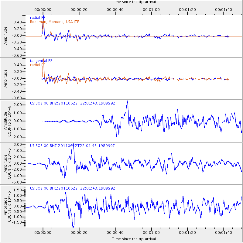
Earthquake location: Near East Coast Of Honshu, Japan
Earthquake latitude/longitude: 40.0/142.2
Earthquake time(UTC): 2011/06/22 (173) 21:50:52 GMT
Earthquake Depth: 33 km
Earthquake Magnitude: 6.7 MW, 6.1 MB, 6.7 MW, 6.7 MS
Earthquake Catalog/Contributor: NEIC PDE/NEIC PDE-M
Network: US United States National Seismic Network
Station: BOZ Bozeman, Montana, USA
Lat/Lon: 45.65 N/111.63 W
Elevation: 1589 m
Distance: 72.2 deg
Az: 45.042 deg
Baz: 309.158 deg
Ray Param: 0.053772125
Estimated Moho Depth: 30.5 km
Estimated Crust Vp/Vs: 2.03
Assumed Crust Vp: 6.35 km/s
Estimated Crust Vs: 3.136 km/s
Estimated Crust Poisson's Ratio: 0.34
Radial Match: 95.86024 %
Radial Bump: 400
Transverse Match: 83.057106 %
Transverse Bump: 400
SOD ConfigId: 558545
Insert Time: 2013-09-18 20:25:45.884 +0000
GWidth: 2.5
Max Bumps: 400
Tol: 0.001

Signal To Noise

ChannelStoNSTALTA
US:BOZ:00:BHZ:20110622T22:01:43.198999Z10.5920948.590171E-78.1099834E-8
US:BOZ:00:BH1:20110622T22:01:43.198999Z4.4938882.5347788E-75.6405028E-8
US:BOZ:00:BH2:20110622T22:01:43.198999Z6.33232453.918523E-76.188127E-8
Arrivals
Ps5.1 SECOND
PpPs14 SECOND
PsPs/PpSs19 SECOND