HAWA Hanford, Washington, USA - Earthquake Result Viewer
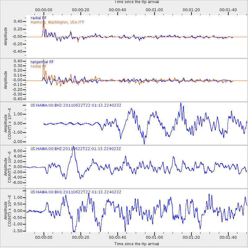
Earthquake location: Near East Coast Of Honshu, Japan
Earthquake latitude/longitude: 40.0/142.2
Earthquake time(UTC): 2011/06/22 (173) 21:50:52 GMT
Earthquake Depth: 33 km
Earthquake Magnitude: 6.7 MW, 6.1 MB, 6.7 MW, 6.7 MS
Earthquake Catalog/Contributor: NEIC PDE/NEIC PDE-M
Network: US United States National Seismic Network
Station: HAWA Hanford, Washington, USA
Lat/Lon: 46.39 N/119.53 W
Elevation: 364 m
Distance: 67.3 deg
Az: 47.922 deg
Baz: 304.482 deg
Ray Param: 0.056967344
Estimated Moho Depth: 36.25 km
Estimated Crust Vp/Vs: 1.72
Assumed Crust Vp: 6.419 km/s
Estimated Crust Vs: 3.743 km/s
Estimated Crust Poisson's Ratio: 0.24
Radial Match: 97.13305 %
Radial Bump: 400
Transverse Match: 86.02862 %
Transverse Bump: 400
SOD ConfigId: 558545
Insert Time: 2013-09-18 20:26:16.600 +0000
GWidth: 2.5
Max Bumps: 400
Tol: 0.001

Signal To Noise

ChannelStoNSTALTA
US:HAWA:00:BHZ:20110622T22:01:13.224023Z11.6432481.1048495E-69.4891874E-8
US:HAWA:00:BH1:20110622T22:01:13.224023Z5.8853352.795425E-74.7498148E-8
US:HAWA:00:BH2:20110622T22:01:13.224023Z5.321463.228607E-76.0671454E-8
Arrivals
Ps4.2 SECOND
PpPs15 SECOND
PsPs/PpSs19 SECOND