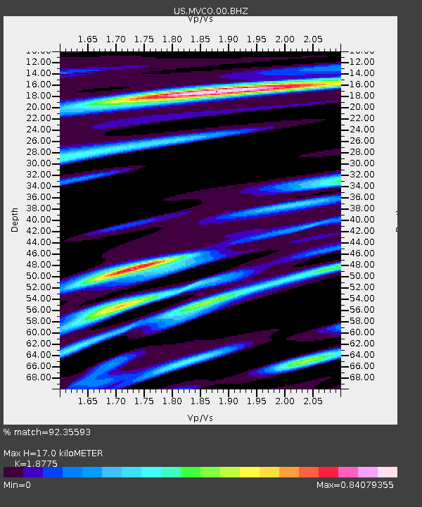
MVCO Mesa Verde, Colorado, USA - Earthquake Result Viewer

Earthquake location: Near East Coast Of Honshu, Japan
Earthquake latitude/longitude: 40.0/142.2
Earthquake time(UTC): 2011/06/22 (173) 21:50:52 GMT
Earthquake Depth: 33 km
Earthquake Magnitude: 6.7 MW, 6.1 MB, 6.7 MW, 6.7 MS
Earthquake Catalog/Contributor: NEIC PDE/NEIC PDE-M
Network: US United States National Seismic Network
Station: MVCO Mesa Verde, Colorado, USA
Lat/Lon: 37.21 N/108.50 W
Elevation: 2170 m
Distance: 79.5 deg
Az: 50.029 deg
Baz: 312.451 deg
Ray Param: 0.04887869
Estimated Moho Depth: 17.0 km
Estimated Crust Vp/Vs: 1.88
Assumed Crust Vp: 6.476 km/s
Estimated Crust Vs: 3.449 km/s
Estimated Crust Poisson's Ratio: 0.30
Radial Match: 92.35593 %
Radial Bump: 400
Transverse Match: 82.59027 %
Transverse Bump: 400
SOD ConfigId: 558545
Insert Time: 2013-09-18 20:26:52.083 +0000
GWidth: 2.5
Max Bumps: 400
Tol: 0.001

Signal To Noise

ChannelStoNSTALTA
US:MVCO:00:BHZ:20110622T22:02:24.524988Z9.0855337.248881E-77.9784876E-8
US:MVCO:00:BH1:20110622T22:02:24.524988Z1.39348341.6745832E-71.2017246E-7
US:MVCO:00:BH2:20110622T22:02:24.524988Z1.6555942.0806982E-71.2567683E-7
Arrivals
Ps2.4 SECOND
PpPs7.3 SECOND
PsPs/PpSs9.7 SECOND