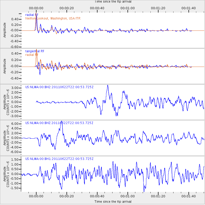
NLWA Neilton Lookout, Washington, USA - Earthquake Result Viewer
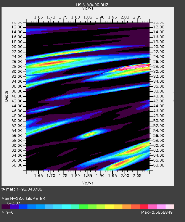
Earthquake location: Near East Coast Of Honshu, Japan
Earthquake latitude/longitude: 40.0/142.2
Earthquake time(UTC): 2011/06/22 (173) 21:50:52 GMT
Earthquake Depth: 33 km
Earthquake Magnitude: 6.7 MW, 6.1 MB, 6.7 MW, 6.7 MS
Earthquake Catalog/Contributor: NEIC PDE/NEIC PDE-M
Network: US United States National Seismic Network
Station: NLWA Neilton Lookout, Washington, USA
Lat/Lon: 47.39 N/123.87 W
Elevation: 640 m
Distance: 64.3 deg
Az: 48.784 deg
Baz: 301.678 deg
Ray Param: 0.058954306
Estimated Moho Depth: 28.0 km
Estimated Crust Vp/Vs: 2.07
Assumed Crust Vp: 6.566 km/s
Estimated Crust Vs: 3.172 km/s
Estimated Crust Poisson's Ratio: 0.35
Radial Match: 95.840706 %
Radial Bump: 400
Transverse Match: 88.120285 %
Transverse Bump: 400
SOD ConfigId: 558545
Insert Time: 2013-09-18 20:27:01.629 +0000
GWidth: 2.5
Max Bumps: 400
Tol: 0.001

Signal To Noise

ChannelStoNSTALTA
US:NLWA:00:BHZ:20110622T22:00:53.725Z17.9156271.483678E-68.281474E-8
US:NLWA:00:BH1:20110622T22:00:53.725Z3.4938133.293758E-79.427402E-8
US:NLWA:00:BH2:20110622T22:00:53.725Z5.30541135.0643695E-79.545667E-8
Arrivals
Ps4.7 SECOND
PpPs13 SECOND
PsPs/PpSs17 SECOND