You are here: Home > Network List > IU - Global Seismograph Network (GSN - IRIS/USGS) Stations List
> Station PMG Port Moresby, New Guinea > Earthquake Result Viewer
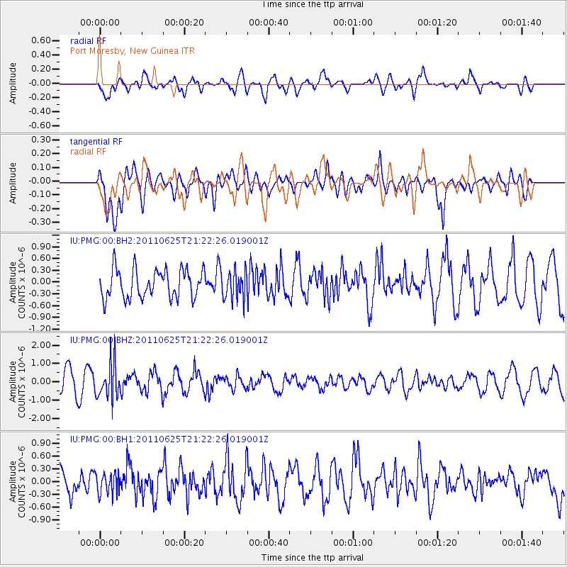
PMG Port Moresby, New Guinea - Earthquake Result Viewer
*The percent match for this event was below the threshold and hence no stack was calculated.
| Earthquake location: |
South Of Fiji Islands |
| Earthquake latitude/longitude: |
-24.5/179.4 |
| Earthquake time(UTC): |
2011/06/25 (176) 21:16:55 GMT |
| Earthquake Depth: |
528 km |
| Earthquake Magnitude: |
5.5 MB, 5.6 MW, 5.6 MW |
| Earthquake Catalog/Contributor: |
WHDF/NEIC |
|
| Network: |
IU Global Seismograph Network (GSN - IRIS/USGS) |
| Station: |
PMG Port Moresby, New Guinea |
| Lat/Lon: |
9.40 S/147.16 E |
| Elevation: |
90 m |
|
| Distance: |
34.2 deg |
| Az: |
290.493 deg |
| Baz: |
120.146 deg |
| Ray Param: |
$rayparam |
*The percent match for this event was below the threshold and hence was not used in the summary stack. |
|
| Radial Match: |
65.189575 % |
| Radial Bump: |
400 |
| Transverse Match: |
59.65765 % |
| Transverse Bump: |
400 |
| SOD ConfigId: |
558545 |
| Insert Time: |
2013-09-18 20:38:39.789 +0000 |
| GWidth: |
2.5 |
| Max Bumps: |
400 |
| Tol: |
0.001 |
|
Signal To Noise
| Channel | StoN | STA | LTA |
| IU:PMG:00:BHZ:20110625T21:22:26.019001Z | 1.3445288 | 9.677362E-7 | 7.197587E-7 |
| IU:PMG:00:BH1:20110625T21:22:26.019001Z | 0.5417336 | 2.397548E-7 | 4.4256956E-7 |
| IU:PMG:00:BH2:20110625T21:22:26.019001Z | 0.9785197 | 3.57027E-7 | 3.648644E-7 |
| Arrivals |
| Ps | |
| PpPs | |
| PsPs/PpSs | |


