You are here: Home > Network List > US - United States National Seismic Network Stations List
> Station HAWA Hanford, Washington, USA > Earthquake Result Viewer
HAWA Hanford, Washington, USA - Earthquake Result Viewer
*The percent match for this event was below the threshold and hence no stack was calculated.
| Earthquake location: |
South Of Fiji Islands |
| Earthquake latitude/longitude: |
-24.5/179.4 |
| Earthquake time(UTC): |
2011/06/25 (176) 21:16:55 GMT |
| Earthquake Depth: |
528 km |
| Earthquake Magnitude: |
5.5 MB, 5.6 MW, 5.6 MW |
| Earthquake Catalog/Contributor: |
WHDF/NEIC |
|
| Network: |
US United States National Seismic Network |
| Station: |
HAWA Hanford, Washington, USA |
| Lat/Lon: |
46.39 N/119.53 W |
| Elevation: |
364 m |
|
| Distance: |
89.6 deg |
| Az: |
37.297 deg |
| Baz: |
232.89 deg |
| Ray Param: |
$rayparam |
*The percent match for this event was below the threshold and hence was not used in the summary stack. |
|
| Radial Match: |
64.391884 % |
| Radial Bump: |
400 |
| Transverse Match: |
41.076225 % |
| Transverse Bump: |
400 |
| SOD ConfigId: |
558545 |
| Insert Time: |
2013-09-18 20:39:07.007 +0000 |
| GWidth: |
2.5 |
| Max Bumps: |
400 |
| Tol: |
0.001 |
|
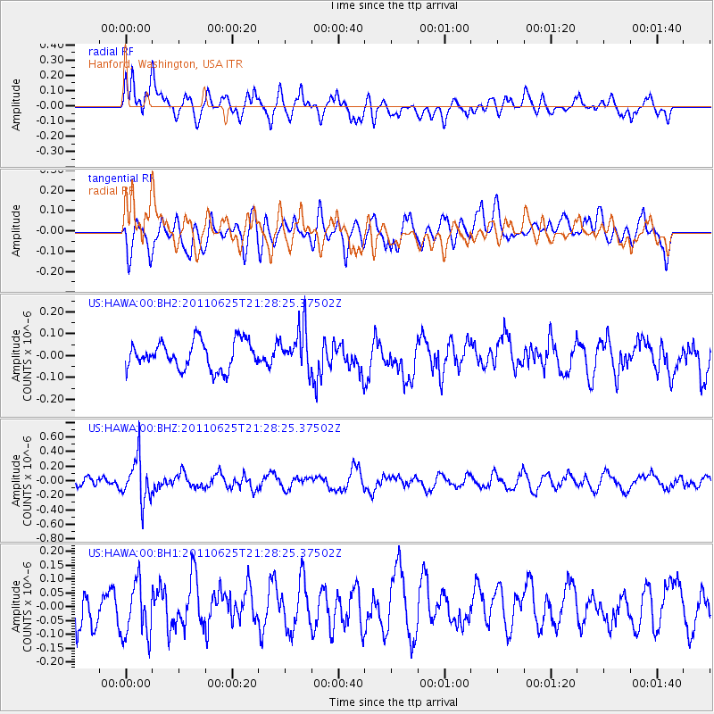
Signal To Noise
| Channel | StoN | STA | LTA |
| US:HAWA:00:BHZ:20110625T21:28:25.37502Z | 4.966632 | 2.9382255E-7 | 5.915932E-8 |
| US:HAWA:00:BH1:20110625T21:28:25.37502Z | 1.2396985 | 9.7930865E-8 | 7.899571E-8 |
| US:HAWA:00:BH2:20110625T21:28:25.37502Z | 1.5171465 | 9.625094E-8 | 6.3442094E-8 |
| Arrivals |
| Ps | |
| PpPs | |
| PsPs/PpSs | |


