You are here: Home > Network List > US - United States National Seismic Network Stations List
> Station MSO Missoula, Montana, USA > Earthquake Result Viewer
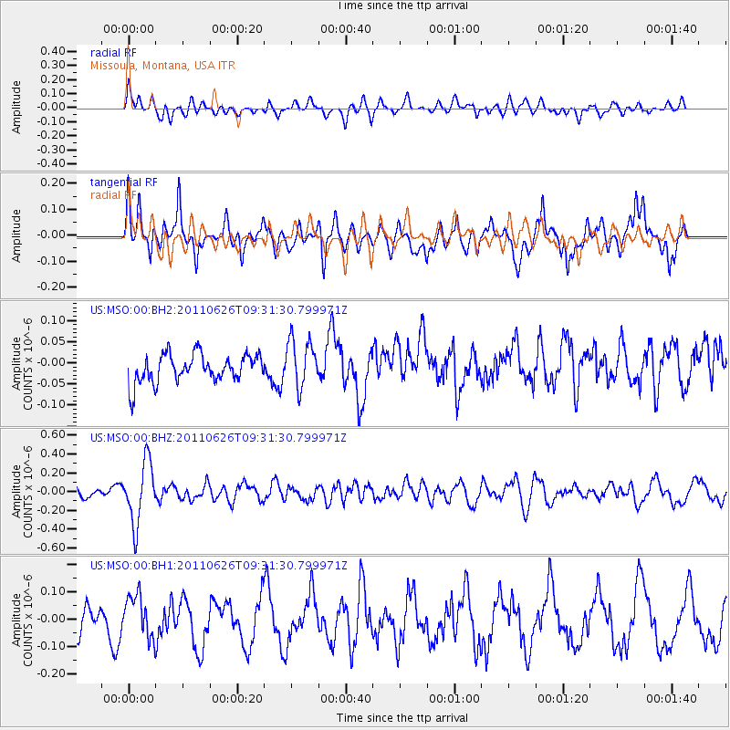
MSO Missoula, Montana, USA - Earthquake Result Viewer
*The percent match for this event was below the threshold and hence no stack was calculated.
| Earthquake location: |
Mariana Islands |
| Earthquake latitude/longitude: |
18.9/146.3 |
| Earthquake time(UTC): |
2011/06/26 (177) 09:19:48 GMT |
| Earthquake Depth: |
99 km |
| Earthquake Magnitude: |
5.6 MB, 5.5 MW, 5.5 MW |
| Earthquake Catalog/Contributor: |
WHDF/NEIC |
|
| Network: |
US United States National Seismic Network |
| Station: |
MSO Missoula, Montana, USA |
| Lat/Lon: |
46.83 N/113.94 W |
| Elevation: |
1264 m |
|
| Distance: |
82.9 deg |
| Az: |
42.987 deg |
| Baz: |
289.889 deg |
| Ray Param: |
$rayparam |
*The percent match for this event was below the threshold and hence was not used in the summary stack. |
|
| Radial Match: |
62.922634 % |
| Radial Bump: |
400 |
| Transverse Match: |
49.50699 % |
| Transverse Bump: |
400 |
| SOD ConfigId: |
558545 |
| Insert Time: |
2013-09-18 20:41:38.795 +0000 |
| GWidth: |
2.5 |
| Max Bumps: |
400 |
| Tol: |
0.001 |
|
Signal To Noise
| Channel | StoN | STA | LTA |
| US:MSO:00:BHZ:20110626T09:31:30.799971Z | 5.296708 | 3.2890694E-7 | 6.209648E-8 |
| US:MSO:00:BH1:20110626T09:31:30.799971Z | 1.5027043 | 8.19171E-8 | 5.4513123E-8 |
| US:MSO:00:BH2:20110626T09:31:30.799971Z | 1.7259958 | 5.754501E-8 | 3.334018E-8 |
| Arrivals |
| Ps | |
| PpPs | |
| PsPs/PpSs | |


