You are here: Home > Network List > US - United States National Seismic Network Stations List
> Station EGMT Eagleton, Montana, USA > Earthquake Result Viewer
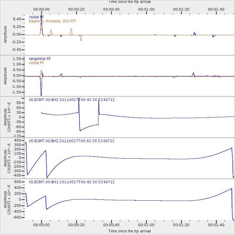
EGMT Eagleton, Montana, USA - Earthquake Result Viewer
*The percent match for this event was below the threshold and hence no stack was calculated.
| Earthquake location: |
Tonga Islands |
| Earthquake latitude/longitude: |
-17.1/-173.7 |
| Earthquake time(UTC): |
2011/06/27 (178) 00:30:29 GMT |
| Earthquake Depth: |
35 km |
| Earthquake Magnitude: |
5.6 MB, 5.5 MW |
| Earthquake Catalog/Contributor: |
NEIC PDE/NEIC PDE-M |
|
| Network: |
US United States National Seismic Network |
| Station: |
EGMT Eagleton, Montana, USA |
| Lat/Lon: |
48.02 N/109.75 W |
| Elevation: |
1055 m |
|
| Distance: |
86.3 deg |
| Az: |
37.18 deg |
| Baz: |
239.416 deg |
| Ray Param: |
$rayparam |
*The percent match for this event was below the threshold and hence was not used in the summary stack. |
|
| Radial Match: |
98.31058 % |
| Radial Bump: |
48 |
| Transverse Match: |
81.30702 % |
| Transverse Bump: |
235 |
| SOD ConfigId: |
558545 |
| Insert Time: |
2013-09-18 20:45:35.711 +0000 |
| GWidth: |
2.5 |
| Max Bumps: |
400 |
| Tol: |
0.001 |
|
Signal To Noise
| Channel | StoN | STA | LTA |
| US:EGMT:00:BHZ:20110627T00:42:36.524971Z | 1.7100948 | 2.9867847E-4 | 1.7465609E-4 |
| US:EGMT:00:BH1:20110627T00:42:36.524971Z | 2.0777476 | 2.0992191E-4 | 1.0103341E-4 |
| US:EGMT:00:BH2:20110627T00:42:36.524971Z | 1.4554802 | 4.887112E-5 | 3.357732E-5 |
| Arrivals |
| Ps | |
| PpPs | |
| PsPs/PpSs | |


