You are here: Home > Network List > IU - Global Seismograph Network (GSN - IRIS/USGS) Stations List
> Station HNR Honiara, Solomon Islands > Earthquake Result Viewer
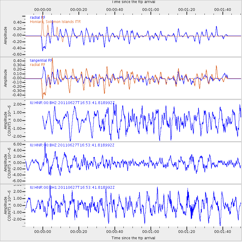
HNR Honiara, Solomon Islands - Earthquake Result Viewer
*The percent match for this event was below the threshold and hence no stack was calculated.
| Earthquake location: |
Flores Region, Indonesia |
| Earthquake latitude/longitude: |
-8.9/122.5 |
| Earthquake time(UTC): |
2011/06/27 (178) 16:47:14 GMT |
| Earthquake Depth: |
120 km |
| Earthquake Magnitude: |
5.8 MB, 5.6 MW, 5.5 MW |
| Earthquake Catalog/Contributor: |
WHDF/NEIC |
|
| Network: |
IU Global Seismograph Network (GSN - IRIS/USGS) |
| Station: |
HNR Honiara, Solomon Islands |
| Lat/Lon: |
9.44 S/159.95 E |
| Elevation: |
100 m |
|
| Distance: |
37.0 deg |
| Az: |
93.839 deg |
| Baz: |
267.682 deg |
| Ray Param: |
$rayparam |
*The percent match for this event was below the threshold and hence was not used in the summary stack. |
|
| Radial Match: |
62.513596 % |
| Radial Bump: |
400 |
| Transverse Match: |
77.024025 % |
| Transverse Bump: |
400 |
| SOD ConfigId: |
558545 |
| Insert Time: |
2013-09-18 20:47:14.622 +0000 |
| GWidth: |
2.5 |
| Max Bumps: |
400 |
| Tol: |
0.001 |
|
Signal To Noise
| Channel | StoN | STA | LTA |
| IU:HNR:00:BHZ:20110627T16:53:41.818992Z | 1.8916934 | 2.4404449E-6 | 1.2900848E-6 |
| IU:HNR:00:BH1:20110627T16:53:41.818992Z | 1.0760115 | 1.0383447E-6 | 9.64994E-7 |
| IU:HNR:00:BH2:20110627T16:53:41.818992Z | 0.9152881 | 8.135766E-7 | 8.8887487E-7 |
| Arrivals |
| Ps | |
| PpPs | |
| PsPs/PpSs | |


