You are here: Home > Network List > US - United States National Seismic Network Stations List
> Station AMTX Amarillo, Texas, USA > Earthquake Result Viewer
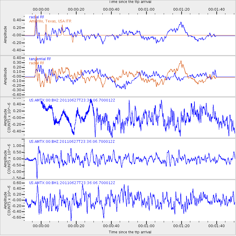
AMTX Amarillo, Texas, USA - Earthquake Result Viewer
*The percent match for this event was below the threshold and hence no stack was calculated.
| Earthquake location: |
Fox Islands, Aleutian Islands |
| Earthquake latitude/longitude: |
52.0/-171.8 |
| Earthquake time(UTC): |
2011/06/27 (178) 23:27:33 GMT |
| Earthquake Depth: |
29 km |
| Earthquake Magnitude: |
5.8 MW, 5.6 MW, 5.9 MB |
| Earthquake Catalog/Contributor: |
NEIC PDE/NEIC PDE-M |
|
| Network: |
US United States National Seismic Network |
| Station: |
AMTX Amarillo, Texas, USA |
| Lat/Lon: |
34.53 N/101.41 W |
| Elevation: |
1010 m |
|
| Distance: |
52.0 deg |
| Az: |
80.463 deg |
| Baz: |
312.403 deg |
| Ray Param: |
$rayparam |
*The percent match for this event was below the threshold and hence was not used in the summary stack. |
|
| Radial Match: |
48.748245 % |
| Radial Bump: |
400 |
| Transverse Match: |
36.12559 % |
| Transverse Bump: |
400 |
| SOD ConfigId: |
558545 |
| Insert Time: |
2013-09-18 20:50:00.552 +0000 |
| GWidth: |
2.5 |
| Max Bumps: |
400 |
| Tol: |
0.001 |
|
Signal To Noise
| Channel | StoN | STA | LTA |
| US:AMTX:00:BHZ:20110627T23:36:06.700012Z | 3.3990636 | 3.0683032E-7 | 9.0269076E-8 |
| US:AMTX:00:BH1:20110627T23:36:06.700012Z | 1.5692097 | 2.6355525E-7 | 1.6795414E-7 |
| US:AMTX:00:BH2:20110627T23:36:06.700012Z | 0.66031957 | 1.292797E-7 | 1.9578354E-7 |
| Arrivals |
| Ps | |
| PpPs | |
| PsPs/PpSs | |


