You are here: Home > Network List > IU - Global Seismograph Network (GSN - IRIS/USGS) Stations List
> Station MAJO Matsushiro, Japan > Earthquake Result Viewer
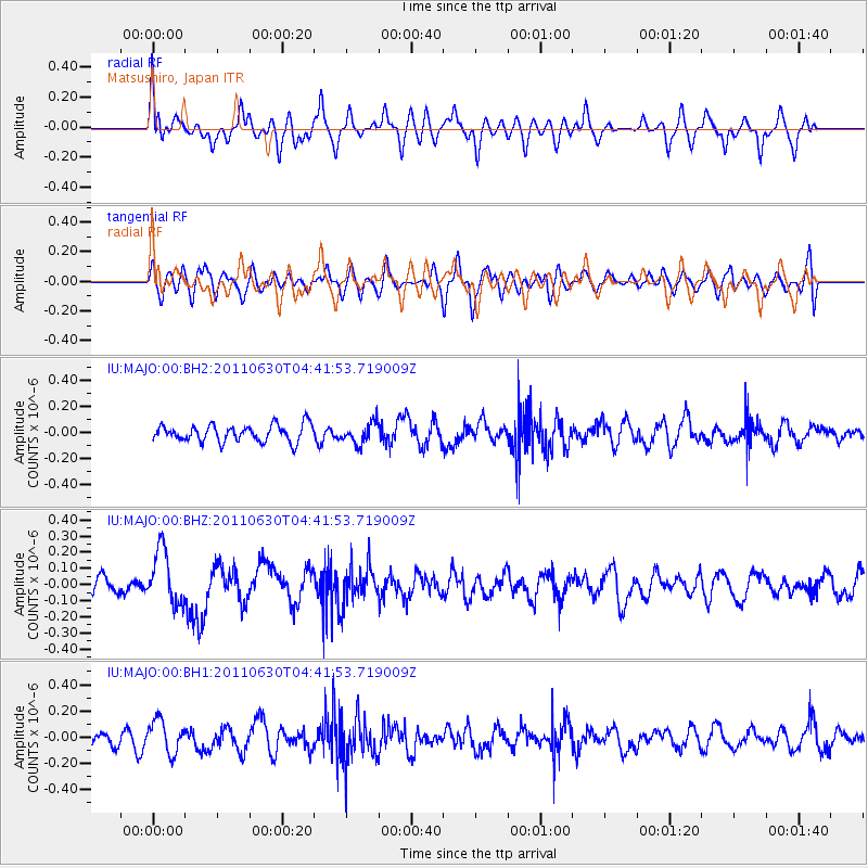
MAJO Matsushiro, Japan - Earthquake Result Viewer
*The percent match for this event was below the threshold and hence no stack was calculated.
| Earthquake location: |
Tonga Islands Region |
| Earthquake latitude/longitude: |
-23.5/-175.9 |
| Earthquake time(UTC): |
2011/06/30 (181) 04:30:54 GMT |
| Earthquake Depth: |
35 km |
| Earthquake Magnitude: |
5.6 MW, 5.6 MW |
| Earthquake Catalog/Contributor: |
NEIC PDE/NEIC PDE-M |
|
| Network: |
IU Global Seismograph Network (GSN - IRIS/USGS) |
| Station: |
MAJO Matsushiro, Japan |
| Lat/Lon: |
36.55 N/138.20 E |
| Elevation: |
405 m |
|
| Distance: |
73.8 deg |
| Az: |
322.974 deg |
| Baz: |
136.64 deg |
| Ray Param: |
$rayparam |
*The percent match for this event was below the threshold and hence was not used in the summary stack. |
|
| Radial Match: |
53.42215 % |
| Radial Bump: |
400 |
| Transverse Match: |
53.054142 % |
| Transverse Bump: |
400 |
| SOD ConfigId: |
558545 |
| Insert Time: |
2013-09-18 21:00:37.468 +0000 |
| GWidth: |
2.5 |
| Max Bumps: |
400 |
| Tol: |
0.001 |
|
Signal To Noise
| Channel | StoN | STA | LTA |
| IU:MAJO:00:BHZ:20110630T04:41:53.719009Z | 3.3420877 | 1.6954552E-7 | 5.073042E-8 |
| IU:MAJO:00:BH1:20110630T04:41:53.719009Z | 1.8332479 | 1.2473772E-7 | 6.8041935E-8 |
| IU:MAJO:00:BH2:20110630T04:41:53.719009Z | 1.260676 | 8.160115E-8 | 6.4728084E-8 |
| Arrivals |
| Ps | |
| PpPs | |
| PsPs/PpSs | |


