You are here: Home > Network List > IU - Global Seismograph Network (GSN - IRIS/USGS) Stations List
> Station MAJO Matsushiro, Japan > Earthquake Result Viewer
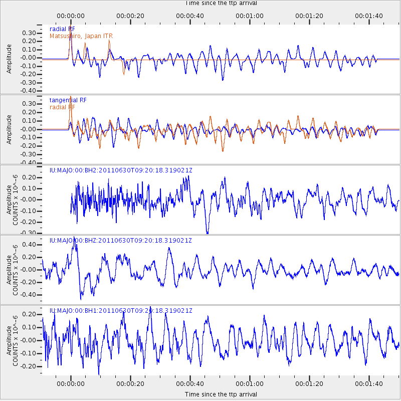
MAJO Matsushiro, Japan - Earthquake Result Viewer
*The percent match for this event was below the threshold and hence no stack was calculated.
| Earthquake location: |
Tonga Islands Region |
| Earthquake latitude/longitude: |
-23.5/-175.8 |
| Earthquake time(UTC): |
2011/06/30 (181) 09:09:18 GMT |
| Earthquake Depth: |
35 km |
| Earthquake Magnitude: |
5.7 MW, 5.5 MB, 5.5 MS, 5.7 MW |
| Earthquake Catalog/Contributor: |
NEIC PDE/NEIC PDE-M |
|
| Network: |
IU Global Seismograph Network (GSN - IRIS/USGS) |
| Station: |
MAJO Matsushiro, Japan |
| Lat/Lon: |
36.55 N/138.20 E |
| Elevation: |
405 m |
|
| Distance: |
73.8 deg |
| Az: |
322.944 deg |
| Baz: |
136.624 deg |
| Ray Param: |
$rayparam |
*The percent match for this event was below the threshold and hence was not used in the summary stack. |
|
| Radial Match: |
68.31814 % |
| Radial Bump: |
400 |
| Transverse Match: |
54.758354 % |
| Transverse Bump: |
400 |
| SOD ConfigId: |
558545 |
| Insert Time: |
2013-09-18 21:02:54.375 +0000 |
| GWidth: |
2.5 |
| Max Bumps: |
400 |
| Tol: |
0.001 |
|
Signal To Noise
| Channel | StoN | STA | LTA |
| IU:MAJO:00:BHZ:20110630T09:20:18.319021Z | 3.7521625 | 3.1027238E-7 | 8.2691614E-8 |
| IU:MAJO:00:BH1:20110630T09:20:18.319021Z | 0.8609957 | 1.0105786E-7 | 1.1737324E-7 |
| IU:MAJO:00:BH2:20110630T09:20:18.319021Z | 0.89390427 | 6.319367E-8 | 7.069399E-8 |
| Arrivals |
| Ps | |
| PpPs | |
| PsPs/PpSs | |


