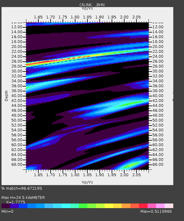
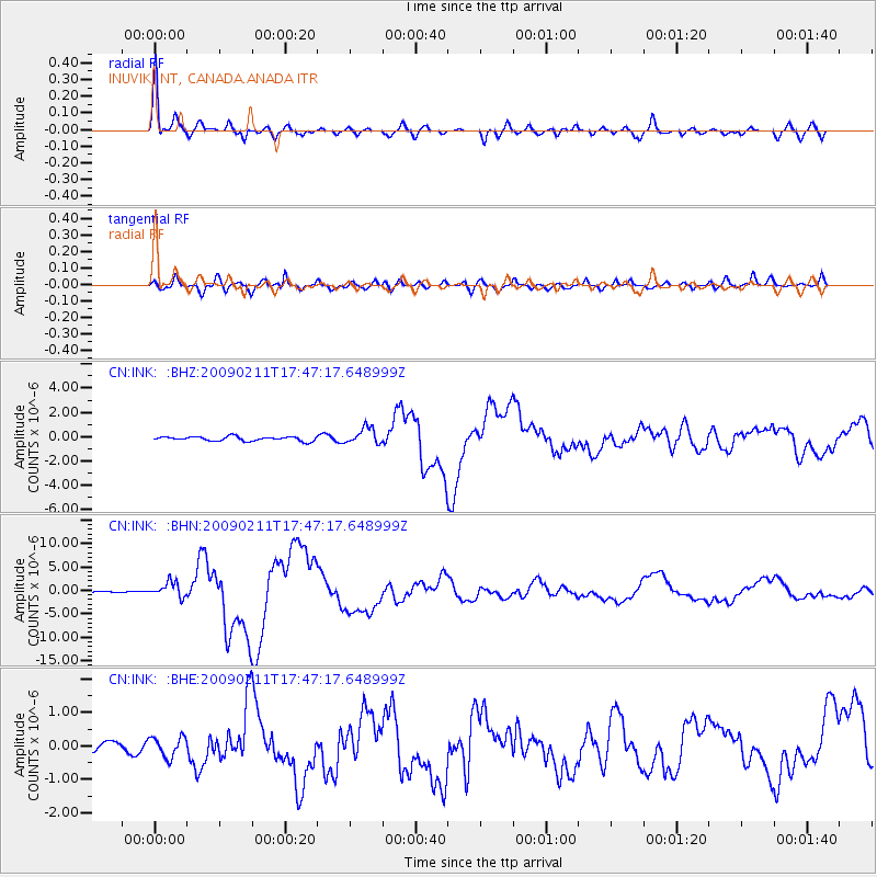
INK INUVIK, NT, CANADA.ANADA - Earthquake Result Viewer

Earthquake location: Talaud Islands, Indonesia
Earthquake latitude/longitude: 3.9/126.4
Earthquake time(UTC): 2009/02/11 (042) 17:34:50 GMT
Earthquake Depth: 22 km
Earthquake Magnitude: 6.6 MB, 7.2 MS, 7.2 MW, 7.1 MW
Earthquake Catalog/Contributor: WHDF/NEIC
Network: CN Canadian National Seismograph Network
Station: INK INUVIK, NT, CANADA.ANADA
Lat/Lon: 68.31 N/133.52 W
Elevation: 40 m
Distance: 90.1 deg
Az: 21.472 deg
Baz: 280.788 deg
Ray Param: 0.041692507
Estimated Moho Depth: 24.5 km
Estimated Crust Vp/Vs: 1.78
Assumed Crust Vp: 6.171 km/s
Estimated Crust Vs: 3.472 km/s
Estimated Crust Poisson's Ratio: 0.27
Radial Match: 96.672195 %
Radial Bump: 400
Transverse Match: 90.86266 %
Transverse Bump: 400
SOD ConfigId: 2658
Insert Time: 2010-02-27 06:07:33.349 +0000
GWidth: 2.5
Max Bumps: 400
Tol: 0.001

Signal To Noise

ChannelStoNSTALTA
CN:INK: :BHN:20090211T17:47:17.648999Z9.0351671.6059103E-61.7773998E-7
CN:INK: :BHE:20090211T17:47:17.648999Z1.6646213.048794E-71.8315244E-7
CN:INK: :BHZ:20090211T17:47:17.648999Z3.73024036.597758E-71.7687219E-7
Arrivals
Ps3.1 SECOND
PpPs11 SECOND
PsPs/PpSs14 SECOND