You are here: Home > Network List > US - United States National Seismic Network Stations List
> Station MSO Missoula, Montana, USA > Earthquake Result Viewer
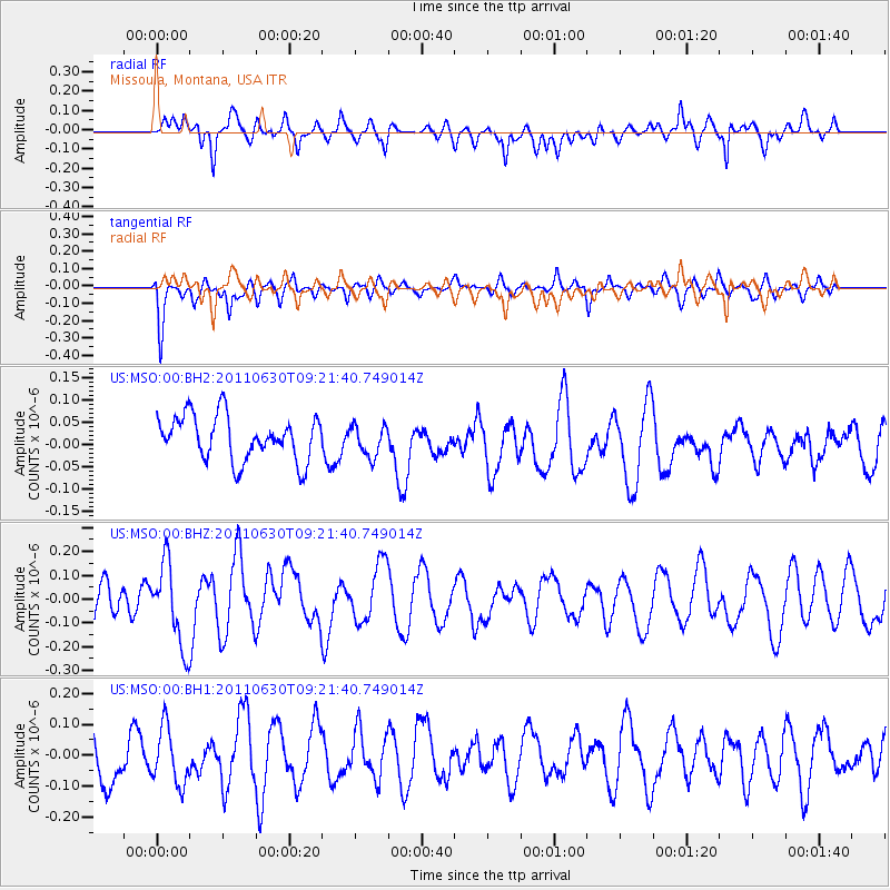
MSO Missoula, Montana, USA - Earthquake Result Viewer
*The percent match for this event was below the threshold and hence no stack was calculated.
| Earthquake location: |
Tonga Islands Region |
| Earthquake latitude/longitude: |
-23.5/-175.8 |
| Earthquake time(UTC): |
2011/06/30 (181) 09:09:18 GMT |
| Earthquake Depth: |
35 km |
| Earthquake Magnitude: |
5.7 MW, 5.5 MB, 5.5 MS, 5.7 MW |
| Earthquake Catalog/Contributor: |
NEIC PDE/NEIC PDE-M |
|
| Network: |
US United States National Seismic Network |
| Station: |
MSO Missoula, Montana, USA |
| Lat/Lon: |
46.83 N/113.94 W |
| Elevation: |
1264 m |
|
| Distance: |
89.5 deg |
| Az: |
37.283 deg |
| Baz: |
234.067 deg |
| Ray Param: |
$rayparam |
*The percent match for this event was below the threshold and hence was not used in the summary stack. |
|
| Radial Match: |
51.703793 % |
| Radial Bump: |
400 |
| Transverse Match: |
43.53651 % |
| Transverse Bump: |
306 |
| SOD ConfigId: |
558545 |
| Insert Time: |
2013-09-18 21:03:58.107 +0000 |
| GWidth: |
2.5 |
| Max Bumps: |
400 |
| Tol: |
0.001 |
|
Signal To Noise
| Channel | StoN | STA | LTA |
| US:MSO:00:BHZ:20110630T09:21:40.749014Z | 2.5760112 | 1.717401E-7 | 6.6669E-8 |
| US:MSO:00:BH1:20110630T09:21:40.749014Z | 1.1847345 | 9.267165E-8 | 7.8221454E-8 |
| US:MSO:00:BH2:20110630T09:21:40.749014Z | 0.69886714 | 3.4509537E-8 | 4.9379256E-8 |
| Arrivals |
| Ps | |
| PpPs | |
| PsPs/PpSs | |


