You are here: Home > Network List > US - United States National Seismic Network Stations List
> Station EGMT Eagleton, Montana, USA > Earthquake Result Viewer
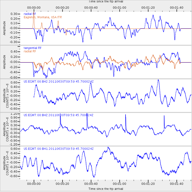
EGMT Eagleton, Montana, USA - Earthquake Result Viewer
*The percent match for this event was below the threshold and hence no stack was calculated.
| Earthquake location: |
Tonga Islands Region |
| Earthquake latitude/longitude: |
-23.6/-175.9 |
| Earthquake time(UTC): |
2011/06/30 (181) 09:47:09 GMT |
| Earthquake Depth: |
35 km |
| Earthquake Magnitude: |
5.5 MW |
| Earthquake Catalog/Contributor: |
NEIC PDE/NEIC PDE-M |
|
| Network: |
US United States National Seismic Network |
| Station: |
EGMT Eagleton, Montana, USA |
| Lat/Lon: |
48.02 N/109.75 W |
| Elevation: |
1055 m |
|
| Distance: |
92.6 deg |
| Az: |
37.916 deg |
| Baz: |
237.136 deg |
| Ray Param: |
$rayparam |
*The percent match for this event was below the threshold and hence was not used in the summary stack. |
|
| Radial Match: |
62.198215 % |
| Radial Bump: |
400 |
| Transverse Match: |
46.443947 % |
| Transverse Bump: |
400 |
| SOD ConfigId: |
558545 |
| Insert Time: |
2013-09-18 21:05:51.412 +0000 |
| GWidth: |
2.5 |
| Max Bumps: |
400 |
| Tol: |
0.001 |
|
Signal To Noise
| Channel | StoN | STA | LTA |
| US:EGMT:00:BHZ:20110630T09:59:45.700024Z | 0.8416916 | 1.690885E-7 | 2.0089126E-7 |
| US:EGMT:00:BH1:20110630T09:59:45.700024Z | 1.6657443 | 6.088493E-7 | 3.6551185E-7 |
| US:EGMT:00:BH2:20110630T09:59:45.700024Z | 0.8970775 | 1.818689E-7 | 2.0273488E-7 |
| Arrivals |
| Ps | |
| PpPs | |
| PsPs/PpSs | |


