You are here: Home > Network List > US - United States National Seismic Network Stations List
> Station HAWA Hanford, Washington, USA > Earthquake Result Viewer
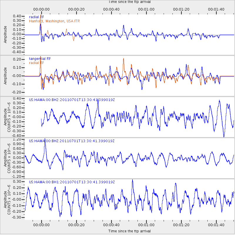
HAWA Hanford, Washington, USA - Earthquake Result Viewer
*The percent match for this event was below the threshold and hence no stack was calculated.
| Earthquake location: |
South Of Mariana Islands |
| Earthquake latitude/longitude: |
13.1/146.6 |
| Earthquake time(UTC): |
2011/07/01 (182) 13:18:50 GMT |
| Earthquake Depth: |
39 km |
| Earthquake Magnitude: |
5.9 MB, 5.2 MS, 5.6 MW, 5.5 MW |
| Earthquake Catalog/Contributor: |
WHDF/NEIC |
|
| Network: |
US United States National Seismic Network |
| Station: |
HAWA Hanford, Washington, USA |
| Lat/Lon: |
46.39 N/119.53 W |
| Elevation: |
364 m |
|
| Distance: |
83.3 deg |
| Az: |
44.051 deg |
| Baz: |
281.852 deg |
| Ray Param: |
$rayparam |
*The percent match for this event was below the threshold and hence was not used in the summary stack. |
|
| Radial Match: |
55.681183 % |
| Radial Bump: |
400 |
| Transverse Match: |
47.983955 % |
| Transverse Bump: |
400 |
| SOD ConfigId: |
558545 |
| Insert Time: |
2013-09-18 21:08:07.566 +0000 |
| GWidth: |
2.5 |
| Max Bumps: |
400 |
| Tol: |
0.001 |
|
Signal To Noise
| Channel | StoN | STA | LTA |
| US:HAWA:00:BHZ:20110701T13:30:41.399019Z | 3.7140465 | 4.86473E-7 | 1.3098193E-7 |
| US:HAWA:00:BH1:20110701T13:30:41.399019Z | 0.7188076 | 9.071134E-8 | 1.2619698E-7 |
| US:HAWA:00:BH2:20110701T13:30:41.399019Z | 1.8309196 | 1.6897458E-7 | 9.228946E-8 |
| Arrivals |
| Ps | |
| PpPs | |
| PsPs/PpSs | |


