You are here: Home > Network List > US - United States National Seismic Network Stations List
> Station HAWA Hanford, Washington, USA > Earthquake Result Viewer
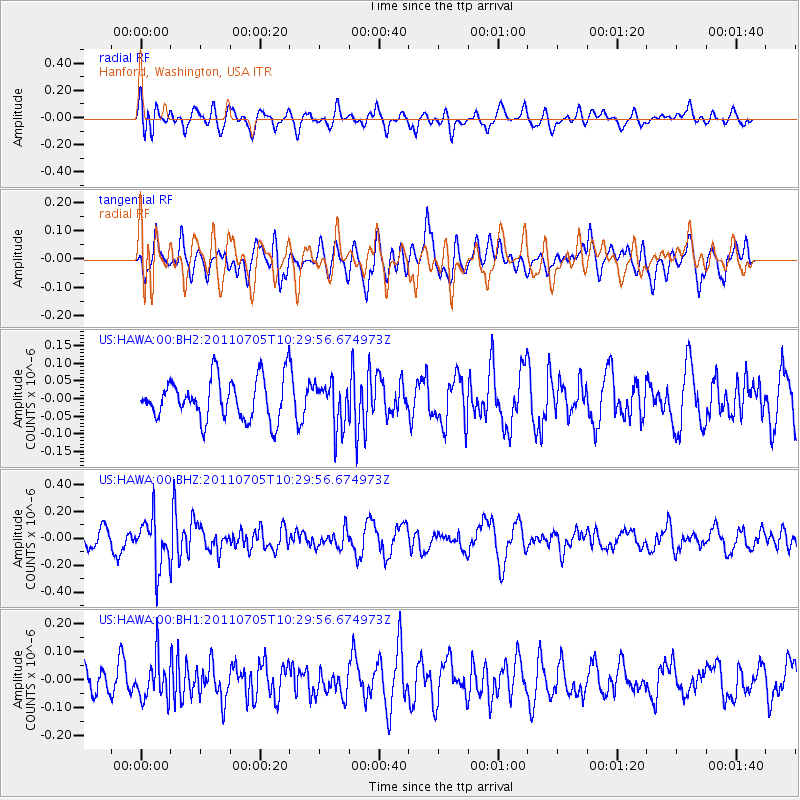
HAWA Hanford, Washington, USA - Earthquake Result Viewer
*The percent match for this event was below the threshold and hence no stack was calculated.
| Earthquake location: |
Near S. Coast Of Western Honshu |
| Earthquake latitude/longitude: |
34.0/135.1 |
| Earthquake time(UTC): |
2011/07/05 (186) 10:18:44 GMT |
| Earthquake Depth: |
16 km |
| Earthquake Magnitude: |
5.5 MB |
| Earthquake Catalog/Contributor: |
NEIC PDE/NEIC PDE-M |
|
| Network: |
US United States National Seismic Network |
| Station: |
HAWA Hanford, Washington, USA |
| Lat/Lon: |
46.39 N/119.53 W |
| Elevation: |
364 m |
|
| Distance: |
75.5 deg |
| Az: |
43.576 deg |
| Baz: |
304.158 deg |
| Ray Param: |
$rayparam |
*The percent match for this event was below the threshold and hence was not used in the summary stack. |
|
| Radial Match: |
59.881454 % |
| Radial Bump: |
400 |
| Transverse Match: |
51.763134 % |
| Transverse Bump: |
400 |
| SOD ConfigId: |
558545 |
| Insert Time: |
2013-09-18 21:15:55.257 +0000 |
| GWidth: |
2.5 |
| Max Bumps: |
400 |
| Tol: |
0.001 |
|
Signal To Noise
| Channel | StoN | STA | LTA |
| US:HAWA:00:BHZ:20110705T10:29:56.674973Z | 1.9452323 | 1.8036128E-7 | 9.271967E-8 |
| US:HAWA:00:BH1:20110705T10:29:56.674973Z | 1.4200147 | 7.192536E-8 | 5.0651142E-8 |
| US:HAWA:00:BH2:20110705T10:29:56.674973Z | 1.0855998 | 6.3609576E-8 | 5.8593944E-8 |
| Arrivals |
| Ps | |
| PpPs | |
| PsPs/PpSs | |


