You are here: Home > Network List > US - United States National Seismic Network Stations List
> Station MSO Missoula, Montana, USA > Earthquake Result Viewer
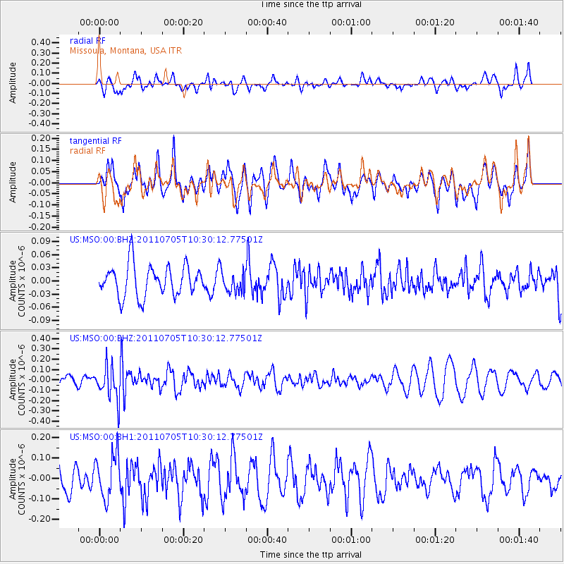
MSO Missoula, Montana, USA - Earthquake Result Viewer
*The percent match for this event was below the threshold and hence no stack was calculated.
| Earthquake location: |
Near S. Coast Of Western Honshu |
| Earthquake latitude/longitude: |
34.0/135.1 |
| Earthquake time(UTC): |
2011/07/05 (186) 10:18:44 GMT |
| Earthquake Depth: |
16 km |
| Earthquake Magnitude: |
5.5 MB |
| Earthquake Catalog/Contributor: |
NEIC PDE/NEIC PDE-M |
|
| Network: |
US United States National Seismic Network |
| Station: |
MSO Missoula, Montana, USA |
| Lat/Lon: |
46.83 N/113.94 W |
| Elevation: |
1264 m |
|
| Distance: |
78.4 deg |
| Az: |
40.895 deg |
| Baz: |
307.606 deg |
| Ray Param: |
$rayparam |
*The percent match for this event was below the threshold and hence was not used in the summary stack. |
|
| Radial Match: |
56.735023 % |
| Radial Bump: |
400 |
| Transverse Match: |
54.246925 % |
| Transverse Bump: |
400 |
| SOD ConfigId: |
558545 |
| Insert Time: |
2013-09-18 21:16:16.928 +0000 |
| GWidth: |
2.5 |
| Max Bumps: |
400 |
| Tol: |
0.001 |
|
Signal To Noise
| Channel | StoN | STA | LTA |
| US:MSO:00:BHZ:20110705T10:30:12.77501Z | 2.0071406 | 1.66211E-7 | 8.280984E-8 |
| US:MSO:00:BH1:20110705T10:30:12.77501Z | 1.5013317 | 1.0799759E-7 | 7.193453E-8 |
| US:MSO:00:BH2:20110705T10:30:12.77501Z | 0.63430864 | 2.2701434E-8 | 3.5789256E-8 |
| Arrivals |
| Ps | |
| PpPs | |
| PsPs/PpSs | |


