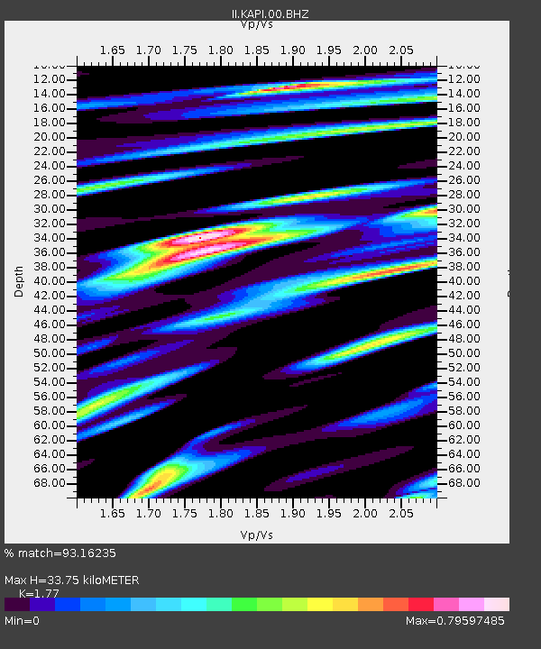
KAPI Kappang, Sulawesi, Indonesia - Earthquake Result Viewer
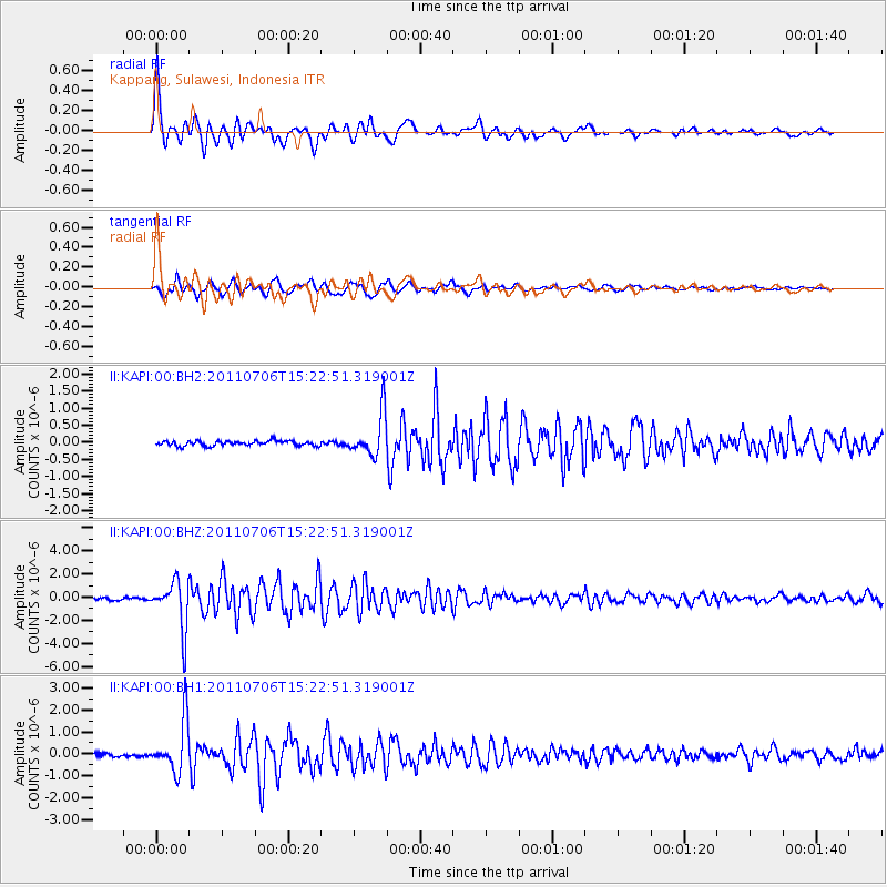
Earthquake location: Near East Coast Of Honshu, Japan
Earthquake latitude/longitude: 36.4/141.6
Earthquake time(UTC): 2011/07/06 (187) 15:14:59 GMT
Earthquake Depth: 10 km
Earthquake Magnitude: 5.7 MW, 5.5 MS, 5.5 MB, 5.7 MW
Earthquake Catalog/Contributor: NEIC PDE/NEIC PDE-M
Network: II Global Seismograph Network (GSN - IRIS/IDA)
Station: KAPI Kappang, Sulawesi, Indonesia
Lat/Lon: 5.01 S/119.75 E
Elevation: 300 m
Distance: 46.0 deg
Az: 211.063 deg
Baz: 24.71 deg
Ray Param: 0.07092872
Estimated Moho Depth: 33.75 km
Estimated Crust Vp/Vs: 1.77
Assumed Crust Vp: 6.343 km/s
Estimated Crust Vs: 3.584 km/s
Estimated Crust Poisson's Ratio: 0.27
Radial Match: 93.16235 %
Radial Bump: 400
Transverse Match: 90.46091 %
Transverse Bump: 400
SOD ConfigId: 558545
Insert Time: 2013-09-18 21:19:13.419 +0000
GWidth: 2.5
Max Bumps: 400
Tol: 0.001

Signal To Noise

ChannelStoNSTALTA
II:KAPI:00:BHZ:20110706T15:22:51.319001Z19.2787632.0496434E-61.0631612E-7
II:KAPI:00:BH1:20110706T15:22:51.319001Z15.5121691.1695079E-67.539293E-8
II:KAPI:00:BH2:20110706T15:22:51.319001Z8.5794746.2506143E-77.285544E-8
Arrivals
Ps4.4 SECOND
PpPs14 SECOND
PsPs/PpSs18 SECOND