You are here: Home > Network List > II - Global Seismograph Network (GSN - IRIS/IDA) Stations List
> Station WRAB Tennant Creek, NT, Australia > Earthquake Result Viewer
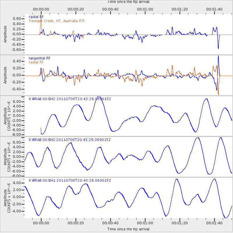
WRAB Tennant Creek, NT, Australia - Earthquake Result Viewer
*The percent match for this event was below the threshold and hence no stack was calculated.
| Earthquake location: |
Kermadec Islands Region |
| Earthquake latitude/longitude: |
-29.6/-176.2 |
| Earthquake time(UTC): |
2011/07/06 (187) 20:35:38 GMT |
| Earthquake Depth: |
10 km |
| Earthquake Magnitude: |
5.6 MB |
| Earthquake Catalog/Contributor: |
NEIC PDE/NEIC PDE-M |
|
| Network: |
II Global Seismograph Network (GSN - IRIS/IDA) |
| Station: |
WRAB Tennant Creek, NT, Australia |
| Lat/Lon: |
19.93 S/134.36 E |
| Elevation: |
366 m |
|
| Distance: |
45.6 deg |
| Az: |
270.429 deg |
| Baz: |
112.182 deg |
| Ray Param: |
$rayparam |
*The percent match for this event was below the threshold and hence was not used in the summary stack. |
|
| Radial Match: |
45.29675 % |
| Radial Bump: |
400 |
| Transverse Match: |
43.956093 % |
| Transverse Bump: |
400 |
| SOD ConfigId: |
558545 |
| Insert Time: |
2013-09-18 21:25:16.754 +0000 |
| GWidth: |
2.5 |
| Max Bumps: |
400 |
| Tol: |
0.001 |
|
Signal To Noise
| Channel | StoN | STA | LTA |
| II:WRAB:00:BHZ:20110706T20:43:28.069015Z | 1.003388 | 2.7957315E-6 | 2.7862916E-6 |
| II:WRAB:00:BH1:20110706T20:43:28.069015Z | 1.5495367 | 3.223442E-6 | 2.0802618E-6 |
| II:WRAB:00:BH2:20110706T20:43:28.069015Z | 1.8965784 | 7.048114E-6 | 3.7162258E-6 |
| Arrivals |
| Ps | |
| PpPs | |
| PsPs/PpSs | |


