
INK INUVIK, NT, CANADA.ANADA - Earthquake Result Viewer
| ||||||||||||||||||
| ||||||||||||||||||
| ||||||||||||||||||
|
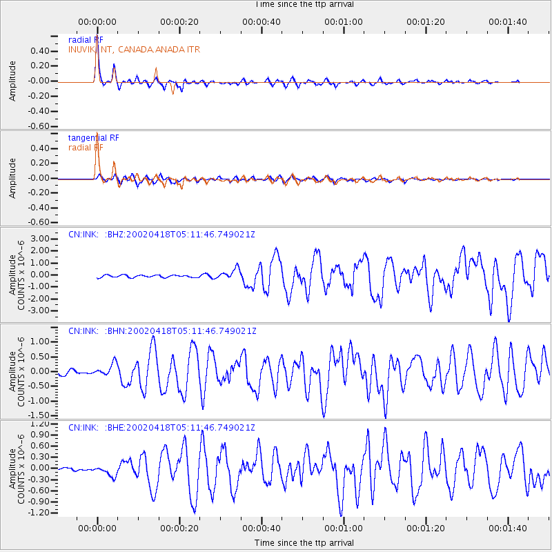
Signal To Noise
| Channel | StoN | STA | LTA |
| CN:INK: :BHN:20020418T05:11:46.749021Z | 3.5230844 | 2.217195E-7 | 6.2933346E-8 |
| CN:INK: :BHE:20020418T05:11:46.749021Z | 2.539006 | 1.3195131E-7 | 5.1969675E-8 |
| CN:INK: :BHZ:20020418T05:11:46.749021Z | 4.561289 | 4.4716415E-7 | 9.8034604E-8 |
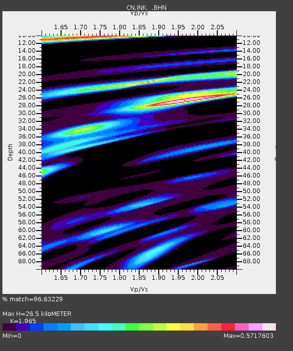
| Arrivals | |
| Ps | 4.3 SECOND |
| PpPs | 12 SECOND |
| PsPs/PpSs | 17 SECOND |

