You are here: Home > Network List > US - United States National Seismic Network Stations List
> Station MSO Missoula, Montana, USA > Earthquake Result Viewer
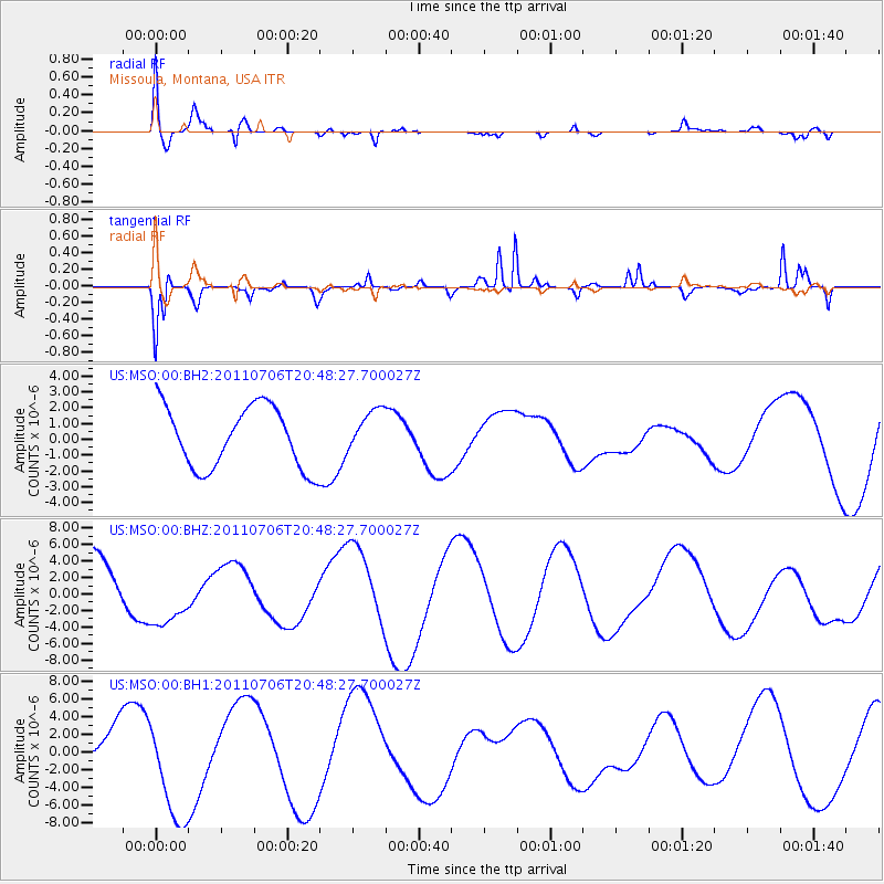
MSO Missoula, Montana, USA - Earthquake Result Viewer
*The percent match for this event was below the threshold and hence no stack was calculated.
| Earthquake location: |
Kermadec Islands Region |
| Earthquake latitude/longitude: |
-29.6/-176.2 |
| Earthquake time(UTC): |
2011/07/06 (187) 20:35:38 GMT |
| Earthquake Depth: |
10 km |
| Earthquake Magnitude: |
5.6 MB |
| Earthquake Catalog/Contributor: |
NEIC PDE/NEIC PDE-M |
|
| Network: |
US United States National Seismic Network |
| Station: |
MSO Missoula, Montana, USA |
| Lat/Lon: |
46.83 N/113.94 W |
| Elevation: |
1264 m |
|
| Distance: |
94.5 deg |
| Az: |
37.58 deg |
| Baz: |
230.7 deg |
| Ray Param: |
$rayparam |
*The percent match for this event was below the threshold and hence was not used in the summary stack. |
|
| Radial Match: |
69.28032 % |
| Radial Bump: |
400 |
| Transverse Match: |
83.24805 % |
| Transverse Bump: |
321 |
| SOD ConfigId: |
558545 |
| Insert Time: |
2013-09-18 21:26:29.041 +0000 |
| GWidth: |
2.5 |
| Max Bumps: |
400 |
| Tol: |
0.001 |
|
Signal To Noise
| Channel | StoN | STA | LTA |
| US:MSO:00:BHZ:20110706T20:48:27.700027Z | 0.9728836 | 3.7623297E-6 | 3.867194E-6 |
| US:MSO:00:BH1:20110706T20:48:27.700027Z | 2.7264109 | 5.9061085E-6 | 2.1662577E-6 |
| US:MSO:00:BH2:20110706T20:48:27.700027Z | 0.7164726 | 1.3955782E-6 | 1.947846E-6 |
| Arrivals |
| Ps | |
| PpPs | |
| PsPs/PpSs | |


