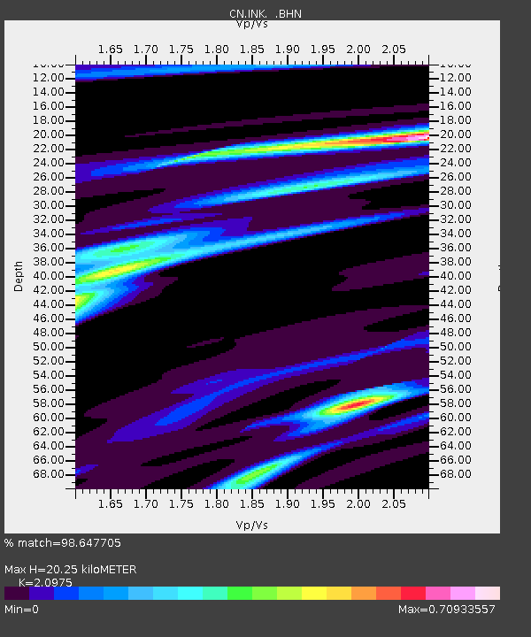
INK INUVIK, N.W.T. - Earthquake Result Viewer

Earthquake location: Near Coast Of Jalisco, Mexico
Earthquake latitude/longitude: 18.8/-104.1
Earthquake time(UTC): 2003/01/22 (022) 02:06:34 GMT
Earthquake Depth: 24 km
Earthquake Magnitude: 6.5 MB, 7.6 MS, 7.6 MW, 7.4 MW
Earthquake Catalog/Contributor: WHDF/NEIC
Network: CN Canadian National Seismograph Network
Station: INK INUVIK, N.W.T.
Lat/Lon: 68.31 N/133.52 W
Elevation: 40 m
Distance: 52.9 deg
Az: 346.758 deg
Baz: 144.285 deg
Ray Param: 0.06645008
Estimated Moho Depth: 20.25 km
Estimated Crust Vp/Vs: 2.10
Assumed Crust Vp: 6.171 km/s
Estimated Crust Vs: 2.942 km/s
Estimated Crust Poisson's Ratio: 0.35
Radial Match: 98.647705 %
Radial Bump: 238
Transverse Match: 88.90459 %
Transverse Bump: 400
SOD ConfigId: 4714
Insert Time: 2010-02-27 06:08:57.542 +0000
GWidth: 2.5
Max Bumps: 400
Tol: 0.001

Signal To Noise

ChannelStoNSTALTA
CN:INK: :BHN:20030122T02:15:17.399001Z5.29380239623.52051817.8845
CN:INK: :BHE:20030122T02:15:17.399001Z3.60540685420.4651503.4268
CN:INK: :BHZ:20030122T02:15:17.399001Z8.40516616465.141958.931
Arrivals
Ps3.8 SECOND
PpPs9.7 SECOND
PsPs/PpSs13 SECOND