You are here: Home > Network List > II - Global Seismograph Network (GSN - IRIS/IDA) Stations List
> Station WRAB Tennant Creek, NT, Australia > Earthquake Result Viewer
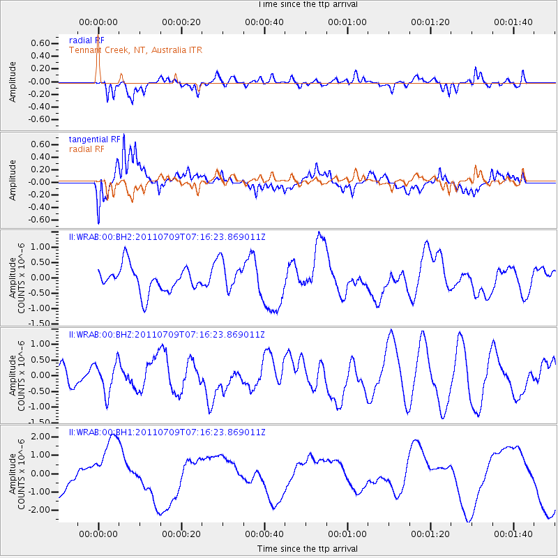
WRAB Tennant Creek, NT, Australia - Earthquake Result Viewer
*The percent match for this event was below the threshold and hence no stack was calculated.
| Earthquake location: |
Tonga Islands |
| Earthquake latitude/longitude: |
-21.2/-174.6 |
| Earthquake time(UTC): |
2011/07/09 (190) 07:08:18 GMT |
| Earthquake Depth: |
10 km |
| Earthquake Magnitude: |
5.6 MW |
| Earthquake Catalog/Contributor: |
NEIC PDE/NEIC PDE-M |
|
| Network: |
II Global Seismograph Network (GSN - IRIS/IDA) |
| Station: |
WRAB Tennant Creek, NT, Australia |
| Lat/Lon: |
19.93 S/134.36 E |
| Elevation: |
366 m |
|
| Distance: |
47.6 deg |
| Az: |
261.915 deg |
| Baz: |
100.814 deg |
| Ray Param: |
$rayparam |
*The percent match for this event was below the threshold and hence was not used in the summary stack. |
|
| Radial Match: |
54.892365 % |
| Radial Bump: |
400 |
| Transverse Match: |
41.472313 % |
| Transverse Bump: |
387 |
| SOD ConfigId: |
558545 |
| Insert Time: |
2013-09-18 21:45:35.612 +0000 |
| GWidth: |
2.5 |
| Max Bumps: |
400 |
| Tol: |
0.001 |
|
Signal To Noise
| Channel | StoN | STA | LTA |
| II:WRAB:00:BHZ:20110709T07:16:23.869011Z | 0.685421 | 5.017924E-7 | 7.3209367E-7 |
| II:WRAB:00:BH1:20110709T07:16:23.869011Z | 1.6885914 | 1.6333246E-6 | 9.672705E-7 |
| II:WRAB:00:BH2:20110709T07:16:23.869011Z | 1.1620903 | 4.7227562E-7 | 4.0640182E-7 |
| Arrivals |
| Ps | |
| PpPs | |
| PsPs/PpSs | |


