You are here: Home > Network List > IU - Global Seismograph Network (GSN - IRIS/USGS) Stations List
> Station MAJO Matsushiro, Japan > Earthquake Result Viewer
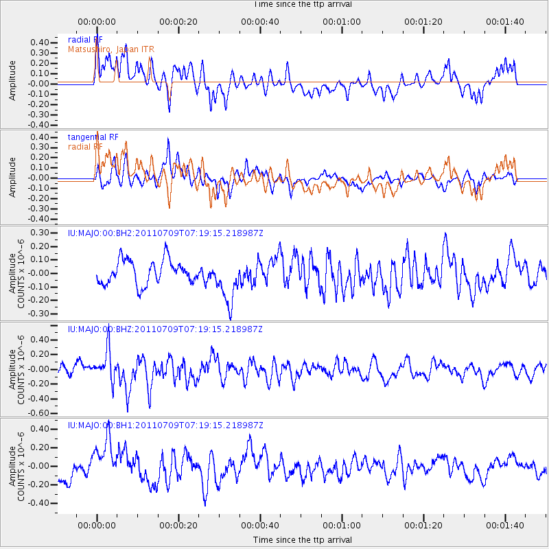
MAJO Matsushiro, Japan - Earthquake Result Viewer
*The percent match for this event was below the threshold and hence no stack was calculated.
| Earthquake location: |
Tonga Islands |
| Earthquake latitude/longitude: |
-21.2/-174.6 |
| Earthquake time(UTC): |
2011/07/09 (190) 07:08:18 GMT |
| Earthquake Depth: |
10 km |
| Earthquake Magnitude: |
5.6 MW |
| Earthquake Catalog/Contributor: |
NEIC PDE/NEIC PDE-M |
|
| Network: |
IU Global Seismograph Network (GSN - IRIS/USGS) |
| Station: |
MAJO Matsushiro, Japan |
| Lat/Lon: |
36.55 N/138.20 E |
| Elevation: |
405 m |
|
| Distance: |
72.6 deg |
| Az: |
321.783 deg |
| Baz: |
134.189 deg |
| Ray Param: |
$rayparam |
*The percent match for this event was below the threshold and hence was not used in the summary stack. |
|
| Radial Match: |
57.341824 % |
| Radial Bump: |
370 |
| Transverse Match: |
67.89737 % |
| Transverse Bump: |
400 |
| SOD ConfigId: |
558545 |
| Insert Time: |
2013-09-18 21:45:55.963 +0000 |
| GWidth: |
2.5 |
| Max Bumps: |
400 |
| Tol: |
0.001 |
|
Signal To Noise
| Channel | StoN | STA | LTA |
| IU:MAJO:00:BHZ:20110709T07:19:15.218987Z | 2.9562824 | 2.2375028E-7 | 7.568637E-8 |
| IU:MAJO:00:BH1:20110709T07:19:15.218987Z | 2.309076 | 2.497335E-7 | 1.08152996E-7 |
| IU:MAJO:00:BH2:20110709T07:19:15.218987Z | 1.9896185 | 1.7645513E-7 | 8.868792E-8 |
| Arrivals |
| Ps | |
| PpPs | |
| PsPs/PpSs | |


