You are here: Home > Network List > US - United States National Seismic Network Stations List
> Station EGMT Eagleton, Montana, USA > Earthquake Result Viewer
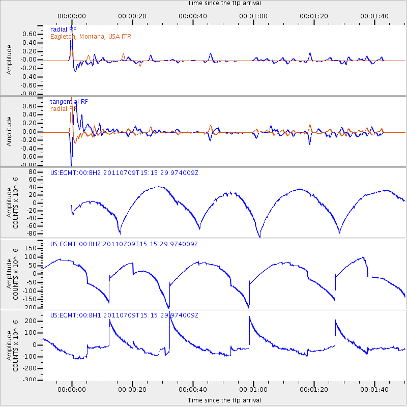
EGMT Eagleton, Montana, USA - Earthquake Result Viewer
*The percent match for this event was below the threshold and hence no stack was calculated.
| Earthquake location: |
Kermadec Islands, New Zealand |
| Earthquake latitude/longitude: |
-29.3/-177.1 |
| Earthquake time(UTC): |
2011/07/09 (190) 15:02:27 GMT |
| Earthquake Depth: |
14 km |
| Earthquake Magnitude: |
5.5 MB, 5.8 MS, 6.0 MW, 5.8 MW |
| Earthquake Catalog/Contributor: |
WHDF/NEIC |
|
| Network: |
US United States National Seismic Network |
| Station: |
EGMT Eagleton, Montana, USA |
| Lat/Lon: |
48.02 N/109.75 W |
| Elevation: |
1055 m |
|
| Distance: |
97.8 deg |
| Az: |
38.683 deg |
| Baz: |
234.384 deg |
| Ray Param: |
$rayparam |
*The percent match for this event was below the threshold and hence was not used in the summary stack. |
|
| Radial Match: |
88.419754 % |
| Radial Bump: |
400 |
| Transverse Match: |
93.39322 % |
| Transverse Bump: |
400 |
| SOD ConfigId: |
558545 |
| Insert Time: |
2013-09-18 21:51:20.194 +0000 |
| GWidth: |
2.5 |
| Max Bumps: |
400 |
| Tol: |
0.001 |
|
Signal To Noise
| Channel | StoN | STA | LTA |
| US:EGMT:00:BHZ:20110709T15:15:29.974009Z | 1.248969 | 7.407793E-5 | 5.9311264E-5 |
| US:EGMT:00:BH1:20110709T15:15:29.974009Z | 1.8585156 | 1.18492746E-4 | 6.3756655E-5 |
| US:EGMT:00:BH2:20110709T15:15:29.974009Z | 1.7211031 | 4.0301667E-5 | 2.3416185E-5 |
| Arrivals |
| Ps | |
| PpPs | |
| PsPs/PpSs | |


