You are here: Home > Network List > IU - Global Seismograph Network (GSN - IRIS/USGS) Stations List
> Station PMG Port Moresby, New Guinea > Earthquake Result Viewer
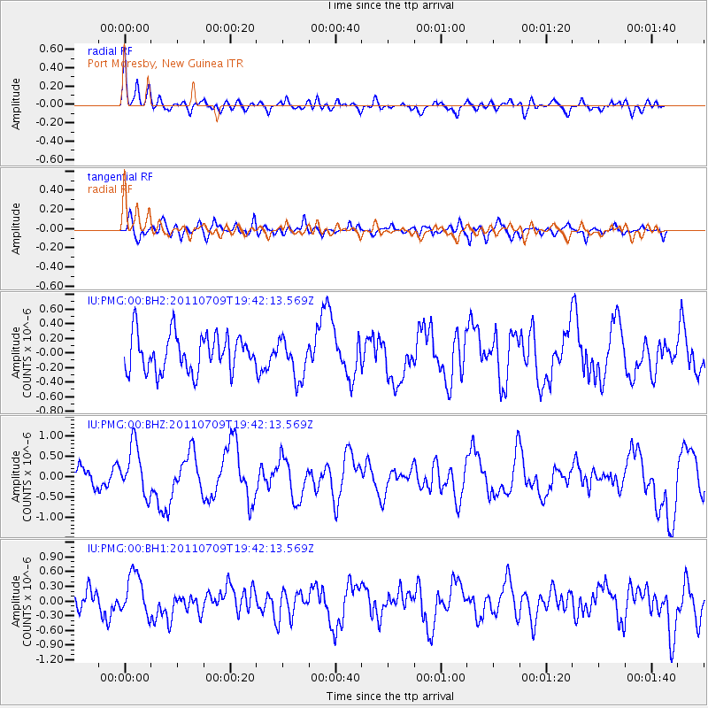
PMG Port Moresby, New Guinea - Earthquake Result Viewer
*The percent match for this event was below the threshold and hence no stack was calculated.
| Earthquake location: |
Kermadec Islands, New Zealand |
| Earthquake latitude/longitude: |
-29.4/-177.0 |
| Earthquake time(UTC): |
2011/07/09 (190) 19:35:18 GMT |
| Earthquake Depth: |
15 km |
| Earthquake Magnitude: |
5.5 MB, 5.8 MS, 5.9 MW, 5.7 MW |
| Earthquake Catalog/Contributor: |
WHDF/NEIC |
|
| Network: |
IU Global Seismograph Network (GSN - IRIS/USGS) |
| Station: |
PMG Port Moresby, New Guinea |
| Lat/Lon: |
9.40 S/147.16 E |
| Elevation: |
90 m |
|
| Distance: |
39.0 deg |
| Az: |
293.363 deg |
| Baz: |
125.751 deg |
| Ray Param: |
$rayparam |
*The percent match for this event was below the threshold and hence was not used in the summary stack. |
|
| Radial Match: |
65.7267 % |
| Radial Bump: |
400 |
| Transverse Match: |
54.487694 % |
| Transverse Bump: |
400 |
| SOD ConfigId: |
558545 |
| Insert Time: |
2013-09-18 21:52:46.816 +0000 |
| GWidth: |
2.5 |
| Max Bumps: |
400 |
| Tol: |
0.001 |
|
Signal To Noise
| Channel | StoN | STA | LTA |
| IU:PMG:00:BHZ:20110709T19:42:13.569Z | 3.4956899 | 6.1796226E-7 | 1.7677834E-7 |
| IU:PMG:00:BH1:20110709T19:42:13.569Z | 1.8487496 | 4.3349073E-7 | 2.3447778E-7 |
| IU:PMG:00:BH2:20110709T19:42:13.569Z | 1.095784 | 2.7721353E-7 | 2.5298192E-7 |
| Arrivals |
| Ps | |
| PpPs | |
| PsPs/PpSs | |


