
ACSO Alum Creek State Park, Ohio, USA - Earthquake Result Viewer
| ||||||||||||||||||
| ||||||||||||||||||
| ||||||||||||||||||
|
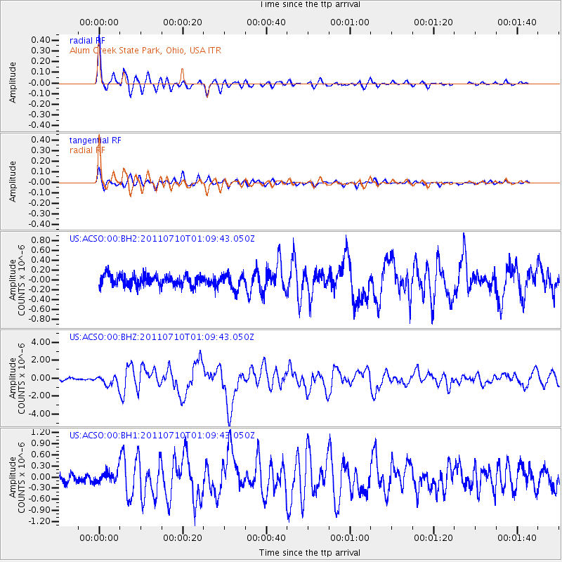
Signal To Noise
| Channel | StoN | STA | LTA |
| US:ACSO:00:BHZ:20110710T01:09:43.050Z | 5.093928 | 5.69212E-7 | 1.11743226E-7 |
| US:ACSO:00:BH1:20110710T01:09:43.050Z | 1.2658527 | 1.591735E-7 | 1.257441E-7 |
| US:ACSO:00:BH2:20110710T01:09:43.050Z | 1.3526415 | 1.5041886E-7 | 1.1120379E-7 |
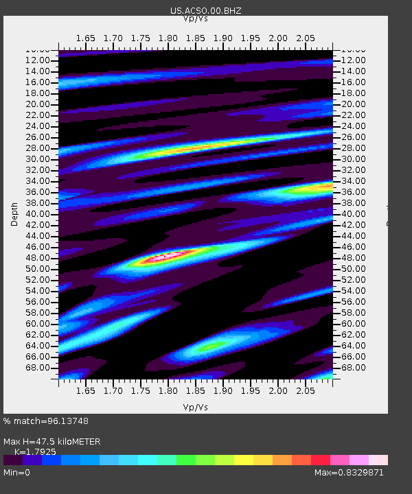
| Arrivals | |
| Ps | 5.9 SECOND |
| PpPs | 20 SECOND |
| PsPs/PpSs | 26 SECOND |

