COWI Conover, Wisconsin, USA - Earthquake Result Viewer
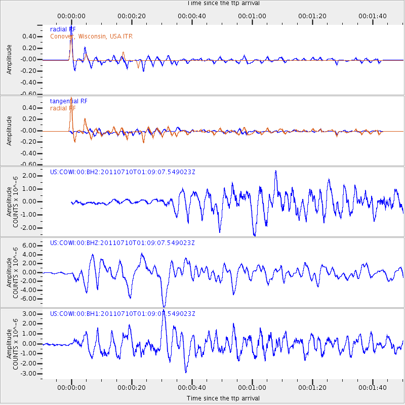
Earthquake location: Off East Coast Of Honshu, Japan
Earthquake latitude/longitude: 38.0/143.3
Earthquake time(UTC): 2011/07/10 (191) 00:57:10 GMT
Earthquake Depth: 23 km
Earthquake Magnitude: 6.6 MB, 7.0 MS, 7.0 MW, 7.0 MW
Earthquake Catalog/Contributor: WHDF/NEIC
Network: US United States National Seismic Network
Station: COWI Conover, Wisconsin, USA
Lat/Lon: 46.10 N/89.14 W
Elevation: 523 m
Distance: 83.9 deg
Az: 33.668 deg
Baz: 321.013 deg
Ray Param: 0.045801308
Estimated Moho Depth: 32.5 km
Estimated Crust Vp/Vs: 1.88
Assumed Crust Vp: 6.467 km/s
Estimated Crust Vs: 3.449 km/s
Estimated Crust Poisson's Ratio: 0.30
Radial Match: 96.67312 %
Radial Bump: 286
Transverse Match: 78.738235 %
Transverse Bump: 400
SOD ConfigId: 558545
Insert Time: 2013-09-18 21:56:01.379 +0000
GWidth: 2.5
Max Bumps: 400
Tol: 0.001

Signal To Noise

ChannelStoNSTALTA
US:COWI:00:BHZ:20110710T01:09:07.549023Z16.080911.4256586E-68.865535E-8
US:COWI:00:BH1:20110710T01:09:07.549023Z4.37163734.5538724E-71.0416857E-7
US:COWI:00:BH2:20110710T01:09:07.549023Z3.06321673.413284E-71.1142809E-7
Arrivals
Ps4.5 SECOND
PpPs14 SECOND
PsPs/PpSs19 SECOND