EYMN Ely, Minnesota, USA - Earthquake Result Viewer
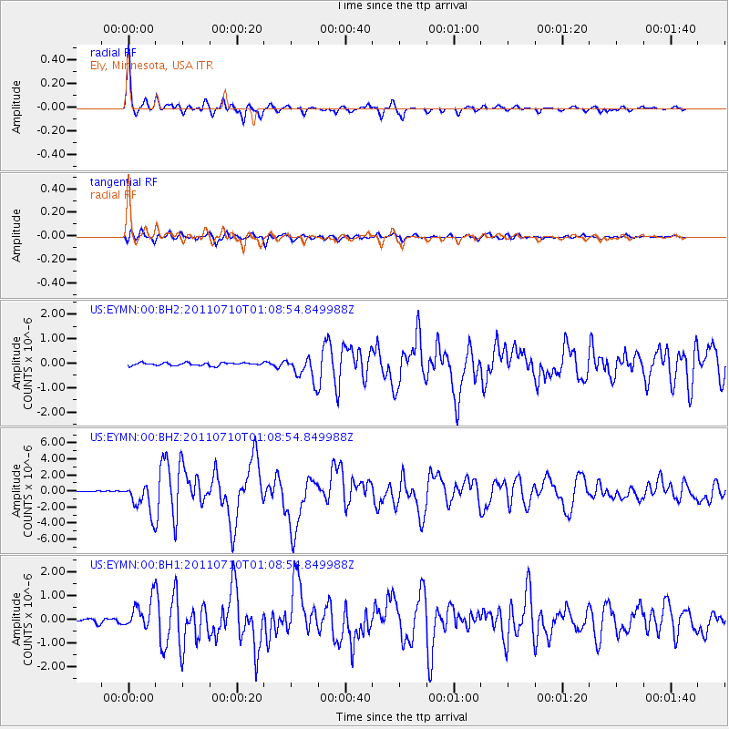
Earthquake location: Off East Coast Of Honshu, Japan
Earthquake latitude/longitude: 38.0/143.3
Earthquake time(UTC): 2011/07/10 (191) 00:57:10 GMT
Earthquake Depth: 23 km
Earthquake Magnitude: 6.6 MB, 7.0 MS, 7.0 MW, 7.0 MW
Earthquake Catalog/Contributor: WHDF/NEIC
Network: US United States National Seismic Network
Station: EYMN Ely, Minnesota, USA
Lat/Lon: 47.95 N/91.50 W
Elevation: 475 m
Distance: 81.5 deg
Az: 33.724 deg
Baz: 319.3 deg
Ray Param: 0.047521234
Estimated Moho Depth: 46.75 km
Estimated Crust Vp/Vs: 1.72
Assumed Crust Vp: 6.467 km/s
Estimated Crust Vs: 3.76 km/s
Estimated Crust Poisson's Ratio: 0.24
Radial Match: 97.15079 %
Radial Bump: 292
Transverse Match: 93.396614 %
Transverse Bump: 400
SOD ConfigId: 558545
Insert Time: 2013-09-18 21:56:18.686 +0000
GWidth: 2.5
Max Bumps: 400
Tol: 0.001

Signal To Noise

ChannelStoNSTALTA
US:EYMN:00:BHZ:20110710T01:08:54.849988Z27.4923061.9304928E-67.0219386E-8
US:EYMN:00:BH1:20110710T01:08:54.849988Z7.58899456.240271E-78.2227906E-8
US:EYMN:00:BH2:20110710T01:08:54.849988Z8.4617214.8904946E-75.7795503E-8
Arrivals
Ps5.4 SECOND
PpPs19 SECOND
PsPs/PpSs24 SECOND