HDIL Hopedale, Illinois, USA - Earthquake Result Viewer
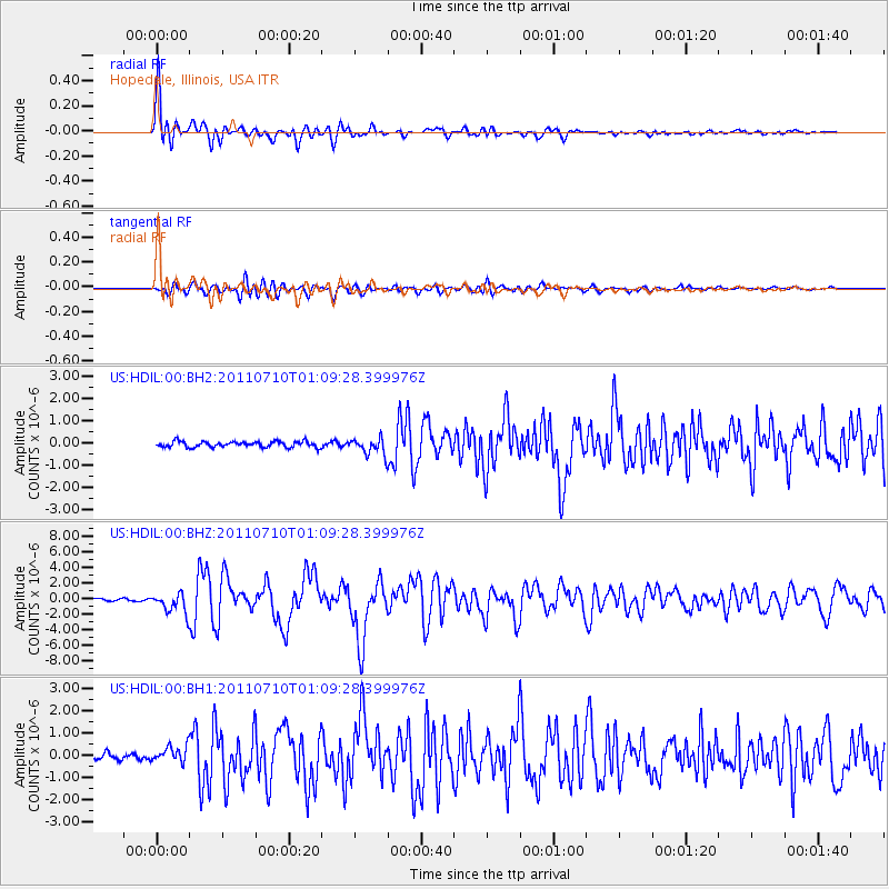
Earthquake location: Off East Coast Of Honshu, Japan
Earthquake latitude/longitude: 38.0/143.3
Earthquake time(UTC): 2011/07/10 (191) 00:57:10 GMT
Earthquake Depth: 23 km
Earthquake Magnitude: 6.6 MB, 7.0 MS, 7.0 MW, 7.0 MW
Earthquake Catalog/Contributor: WHDF/NEIC
Network: US United States National Seismic Network
Station: HDIL Hopedale, Illinois, USA
Lat/Lon: 40.56 N/89.29 W
Elevation: 219 m
Distance: 88.2 deg
Az: 37.247 deg
Baz: 321.151 deg
Ray Param: 0.04274876
Estimated Moho Depth: 17.5 km
Estimated Crust Vp/Vs: 1.60
Assumed Crust Vp: 6.498 km/s
Estimated Crust Vs: 4.061 km/s
Estimated Crust Poisson's Ratio: 0.18
Radial Match: 95.418564 %
Radial Bump: 400
Transverse Match: 83.16565 %
Transverse Bump: 400
SOD ConfigId: 558545
Insert Time: 2013-09-18 21:56:25.590 +0000
GWidth: 2.5
Max Bumps: 400
Tol: 0.001

Signal To Noise

ChannelStoNSTALTA
US:HDIL:00:BHZ:20110710T01:09:28.399976Z9.1706961.2986043E-61.4160368E-7
US:HDIL:00:BH1:20110710T01:09:28.399976Z2.29829653.5590398E-71.5485556E-7
US:HDIL:00:BH2:20110710T01:09:28.399976Z2.84360653.6909054E-71.2979663E-7
Arrivals
Ps1.7 SECOND
PpPs6.8 SECOND
PsPs/PpSs8.5 SECOND