LAO LASA Array, Montana, USA - Earthquake Result Viewer
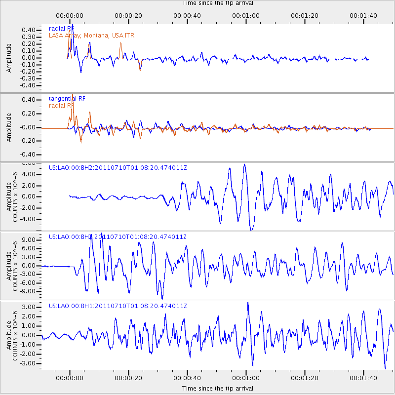
Earthquake location: Off East Coast Of Honshu, Japan
Earthquake latitude/longitude: 38.0/143.3
Earthquake time(UTC): 2011/07/10 (191) 00:57:10 GMT
Earthquake Depth: 23 km
Earthquake Magnitude: 6.6 MB, 7.0 MS, 7.0 MW, 7.0 MW
Earthquake Catalog/Contributor: WHDF/NEIC
Network: US United States National Seismic Network
Station: LAO LASA Array, Montana, USA
Lat/Lon: 46.69 N/106.22 W
Elevation: 902 m
Distance: 75.3 deg
Az: 41.814 deg
Baz: 310.113 deg
Ray Param: 0.05176833
Estimated Moho Depth: 50.75 km
Estimated Crust Vp/Vs: 1.84
Assumed Crust Vp: 6.438 km/s
Estimated Crust Vs: 3.494 km/s
Estimated Crust Poisson's Ratio: 0.29
Radial Match: 95.87499 %
Radial Bump: 280
Transverse Match: 89.58824 %
Transverse Bump: 400
SOD ConfigId: 558545
Insert Time: 2013-09-18 21:56:43.891 +0000
GWidth: 2.5
Max Bumps: 400
Tol: 0.001

Signal To Noise

ChannelStoNSTALTA
US:LAO:00:BHZ:20110710T01:08:20.474011Z14.0094021.449056E-61.0343454E-7
US:LAO:00:BH1:20110710T01:08:20.474011Z1.46412752.583535E-71.764556E-7
US:LAO:00:BH2:20110710T01:08:20.474011Z3.01334366.4928554E-72.1547012E-7
Arrivals
Ps6.9 SECOND
PpPs22 SECOND
PsPs/PpSs29 SECOND