MSO Missoula, Montana, USA - Earthquake Result Viewer
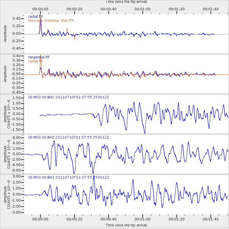
Earthquake location: Off East Coast Of Honshu, Japan
Earthquake latitude/longitude: 38.0/143.3
Earthquake time(UTC): 2011/07/10 (191) 00:57:10 GMT
Earthquake Depth: 23 km
Earthquake Magnitude: 6.6 MB, 7.0 MS, 7.0 MW, 7.0 MW
Earthquake Catalog/Contributor: WHDF/NEIC
Network: US United States National Seismic Network
Station: MSO Missoula, Montana, USA
Lat/Lon: 46.83 N/113.94 W
Elevation: 1264 m
Distance: 71.0 deg
Az: 45.093 deg
Baz: 305.459 deg
Ray Param: 0.05460052
Estimated Moho Depth: 38.0 km
Estimated Crust Vp/Vs: 1.73
Assumed Crust Vp: 6.353 km/s
Estimated Crust Vs: 3.667 km/s
Estimated Crust Poisson's Ratio: 0.25
Radial Match: 94.82097 %
Radial Bump: 400
Transverse Match: 82.87346 %
Transverse Bump: 400
SOD ConfigId: 558545
Insert Time: 2013-09-18 21:57:00.945 +0000
GWidth: 2.5
Max Bumps: 400
Tol: 0.001

Signal To Noise

ChannelStoNSTALTA
US:MSO:00:BHZ:20110710T01:07:55.250012Z15.2348721.1838604E-67.770728E-8
US:MSO:00:BH1:20110710T01:07:55.250012Z6.92765573.717935E-75.366801E-8
US:MSO:00:BH2:20110710T01:07:55.250012Z3.39975361.6131429E-74.7448818E-8
Arrivals
Ps4.5 SECOND
PpPs16 SECOND
PsPs/PpSs20 SECOND