NEW Newport, Washington, USA - Earthquake Result Viewer
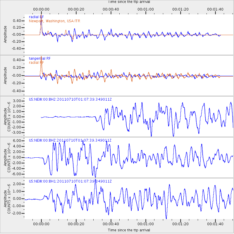
Earthquake location: Off East Coast Of Honshu, Japan
Earthquake latitude/longitude: 38.0/143.3
Earthquake time(UTC): 2011/07/10 (191) 00:57:10 GMT
Earthquake Depth: 23 km
Earthquake Magnitude: 6.6 MB, 7.0 MS, 7.0 MW, 7.0 MW
Earthquake Catalog/Contributor: WHDF/NEIC
Network: US United States National Seismic Network
Station: NEW Newport, Washington, USA
Lat/Lon: 48.26 N/117.12 W
Elevation: 760 m
Distance: 68.4 deg
Az: 45.124 deg
Baz: 303.13 deg
Ray Param: 0.056310017
Estimated Moho Depth: 48.75 km
Estimated Crust Vp/Vs: 1.72
Assumed Crust Vp: 6.571 km/s
Estimated Crust Vs: 3.826 km/s
Estimated Crust Poisson's Ratio: 0.24
Radial Match: 94.45761 %
Radial Bump: 400
Transverse Match: 86.24495 %
Transverse Bump: 400
SOD ConfigId: 558545
Insert Time: 2013-09-18 21:57:08.666 +0000
GWidth: 2.5
Max Bumps: 400
Tol: 0.001

Signal To Noise

ChannelStoNSTALTA
US:NEW:00:BHZ:20110710T01:07:39.349011Z22.5129681.3146158E-65.8393713E-8
US:NEW:00:BH1:20110710T01:07:39.349011Z7.51534132.8495964E-73.791706E-8
US:NEW:00:BH2:20110710T01:07:39.349011Z8.9105674.6486383E-75.216995E-8
Arrivals
Ps5.6 SECOND
PpPs19 SECOND
PsPs/PpSs25 SECOND