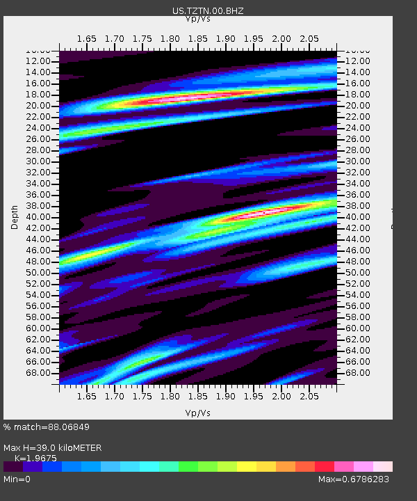
TZTN Tazewell, Tennessee, USA - Earthquake Result Viewer
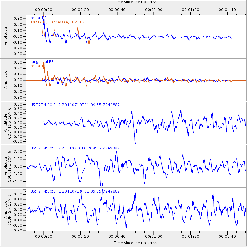
Earthquake location: Off East Coast Of Honshu, Japan
Earthquake latitude/longitude: 38.0/143.3
Earthquake time(UTC): 2011/07/10 (191) 00:57:10 GMT
Earthquake Depth: 23 km
Earthquake Magnitude: 6.6 MB, 7.0 MS, 7.0 MW, 7.0 MW
Earthquake Catalog/Contributor: WHDF/NEIC
Network: US United States National Seismic Network
Station: TZTN Tazewell, Tennessee, USA
Lat/Lon: 36.54 N/83.55 W
Elevation: 394 m
Distance: 94.1 deg
Az: 36.063 deg
Baz: 324.744 deg
Ray Param: 0.04111629
Estimated Moho Depth: 39.0 km
Estimated Crust Vp/Vs: 1.97
Assumed Crust Vp: 6.476 km/s
Estimated Crust Vs: 3.291 km/s
Estimated Crust Poisson's Ratio: 0.33
Radial Match: 88.06849 %
Radial Bump: 400
Transverse Match: 69.75971 %
Transverse Bump: 400
SOD ConfigId: 558545
Insert Time: 2013-09-18 21:57:32.762 +0000
GWidth: 2.5
Max Bumps: 400
Tol: 0.001

Signal To Noise

ChannelStoNSTALTA
US:TZTN:00:BHZ:20110710T01:09:55.724988Z3.06377654.1933035E-71.3686716E-7
US:TZTN:00:BH1:20110710T01:09:55.724988Z1.31749191.01768606E-77.72442E-8
US:TZTN:00:BH2:20110710T01:09:55.724988Z1.3110321.00095946E-77.634897E-8
Arrivals
Ps5.9 SECOND
PpPs18 SECOND
PsPs/PpSs23 SECOND