You are here: Home > Network List > US - United States National Seismic Network Stations List
> Station HAWA Hanford, Washington, USA > Earthquake Result Viewer
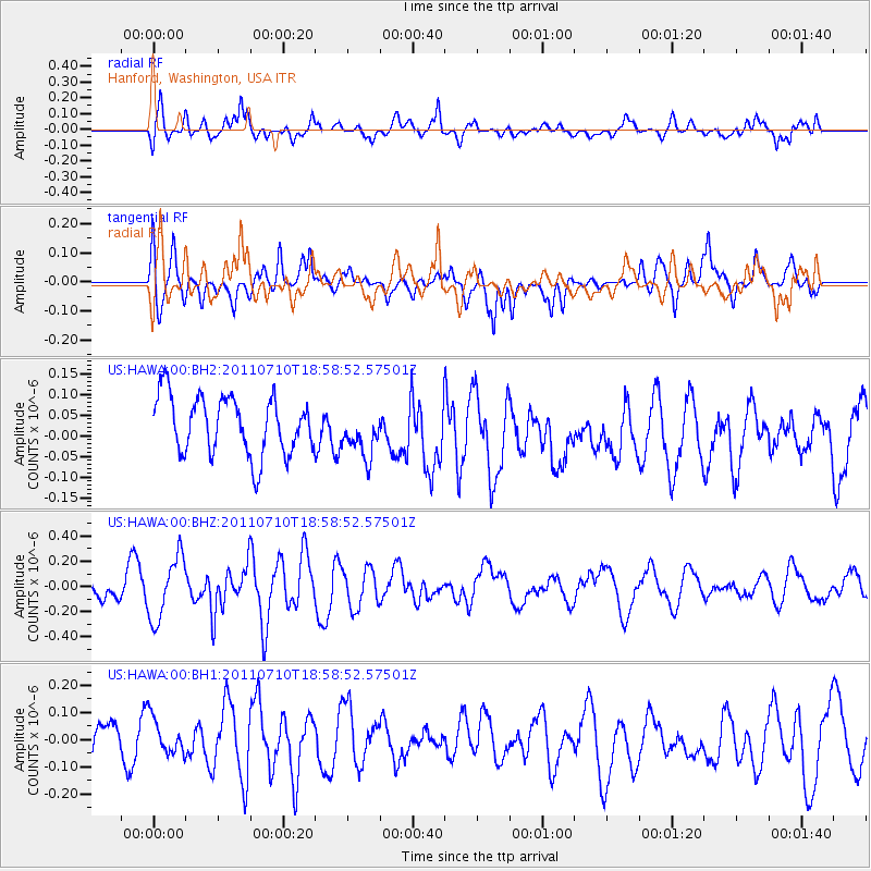
HAWA Hanford, Washington, USA - Earthquake Result Viewer
*The percent match for this event was below the threshold and hence no stack was calculated.
| Earthquake location: |
Fiji Islands Region |
| Earthquake latitude/longitude: |
-15.4/-176.1 |
| Earthquake time(UTC): |
2011/07/10 (191) 18:47:15 GMT |
| Earthquake Depth: |
10 km |
| Earthquake Magnitude: |
5.7 MW |
| Earthquake Catalog/Contributor: |
NEIC PDE/NEIC PDE-M |
|
| Network: |
US United States National Seismic Network |
| Station: |
HAWA Hanford, Washington, USA |
| Lat/Lon: |
46.39 N/119.53 W |
| Elevation: |
364 m |
|
| Distance: |
79.8 deg |
| Az: |
35.93 deg |
| Baz: |
234.852 deg |
| Ray Param: |
$rayparam |
*The percent match for this event was below the threshold and hence was not used in the summary stack. |
|
| Radial Match: |
54.183968 % |
| Radial Bump: |
400 |
| Transverse Match: |
51.053707 % |
| Transverse Bump: |
400 |
| SOD ConfigId: |
558545 |
| Insert Time: |
2013-09-18 21:59:18.229 +0000 |
| GWidth: |
2.5 |
| Max Bumps: |
400 |
| Tol: |
0.001 |
|
Signal To Noise
| Channel | StoN | STA | LTA |
| US:HAWA:00:BHZ:20110710T18:58:52.57501Z | 2.6281075 | 2.5006563E-7 | 9.5150455E-8 |
| US:HAWA:00:BH1:20110710T18:58:52.57501Z | 0.89777577 | 7.162634E-8 | 7.978199E-8 |
| US:HAWA:00:BH2:20110710T18:58:52.57501Z | 0.83399326 | 5.8218895E-8 | 6.980739E-8 |
| Arrivals |
| Ps | |
| PpPs | |
| PsPs/PpSs | |


